South Croxton
| South Croxton | |
|---|---|
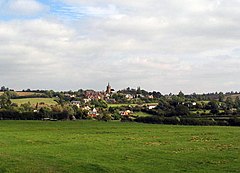
 A view towards South Croxton |
|
| South Croxton shown within Leicestershire | |
| Population | 261 (2011) |
| OS grid reference | SK685105 |
| District | |
| Shire county | |
| Region | |
| Country | England |
| Sovereign state | United Kingdom |
| Post town | Leicester |
| Postcode district | LE7 |
| Police | Leicestershire |
| Fire | Leicestershire |
| Ambulance | East Midlands |
| EU Parliament | East Midlands |
South Croxton (traditionally pronounced "crow-sun" [ˈkroʊsən]) is a village and civil parish in the Charnwood district of Leicestershire, England. It has a population of around 250, measured at 261 in the 2011 census. Nearby places are Beeby, Barsby and Twyford.
The Parish Council meets on the first Monday of the month in the Village Hall. The meetings are open. The Village Hall Committee meets there on the second Thursday of the month. A programme of improvements to the hall begun in 2007 continues. The Golden Fleece reopened in 2008 as a pub/restaurant. The village also has riding stables in Three Turns Lane, a Women's Institute that meets monthly, and a Wednesday Luncheon Club meeting every other month. The village is served on Monday to Saturday by the hourly daytime bus service No. 100 between Leicester and Melton Mowbray. The nearest railway station is at Leicester (8 km). The local school closed about 1965. The nearest primary school today is at Gaddesby (4 km). There have been no shops since 1995, but there is a playing field with a slide and a single football goal.
The recorded population of South Croxton in the last two centuries varied between a high of 324 in 1851 and to a low of 153 in 1951. It was 234 at the time of the 2001 census. The highest point is the church, at 120 metres above mean sea level. This falls to 85 metres by the Queniborough Brook. The moated area to the north of the church formed part of a medieval manor enclosure and has yielded Saxon remains. Signs of medieval ridge and furrow field patterns can be seen to the north of the moated area.
The Grade II* listed Church of St John's and four farmhouses in the parish (Bell Dip, Hill Top, North Manor, South Manor) are listed historic buildings. The village was designated as a Conservation Area in 1975, for its special architectural and historic interest. It has 90 houses, a 14th-century church, a pub (the Golden Fleece) and a village hall, formerly the local school. A considerable number of unlisted buildings are also of architectural interest, having "survived relatively unchanged over the last hundred years." Some are still roofed in slate that was quarried at nearby Swithland, some later ones in Welsh slate.
...
Wikipedia

