South Bishop Lighthouse

South Bishop Lighthouse from the sea.
|
|
|
Wales
|
|
| Location |
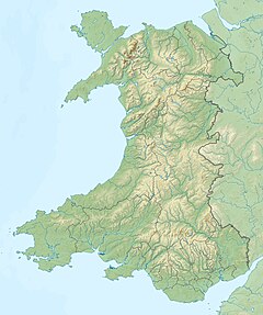
South Bishop island St George's Channel Wales United Kingdom |
|---|---|
| Coordinates | 51°51′10″N 5°24′43″W / 51.852714°N 5.411925°WCoordinates: 51°51′10″N 5°24′43″W / 51.852714°N 5.411925°W |
| Year first constructed | 1839 |
| Automated | 1983 |
| Construction | brick tower |
| Tower shape | cylindrical tower with balcony and lantern |
| Markings / pattern | white tower and lantern |
| Height | 11 m (36 ft) |
| Focal height | 44 m (144 ft) |
| Current lens | 4th Order Catadioptric |
| Light source | solar power |
| Intensity | 60,000 CD |
| Range | 16 nmi (30 km) |
| Characteristic | Fl W 5s. |
| Fog signal | 3 blasts every 45s. (range of 2 nmi (3.7 km)) |
| Admiralty number | A5276 |
| NGA number | 5596 |
| ARLHS number | WAL-024 |
| Managing agent |
Trinity House |
Trinity House
The South Bishop Lighthouse is a lighthouse on South Bishop Island (also known as Emsger), a small rock approximately 5 miles (8 km) west of St Davids Head in Pembrokeshire, Wales.
Designed by James Walker, it was built on the island in 1839, acting both as a waymark for vessels navigating offshore and as assistance to ships navigating around the island group.
The lighthouse was converted to electric operation in 1959, and in 1971 a helipad was constructed at the site. Finally, the lighthouse was automated and demanned in 1983.
Like many in the UK, it is now monitored from the control centre at Trinity House in Harwich, Essex, England.
It was built in the path of many migrating sea birds, and the brilliance of the light at night often led the birds to dash themselves against the lantern. Many died and, when Trinity House and the Royal Society for the Protection of Birds teamed up, they together came to the conclusion to build special bird perches on the side of the lighthouse lantern. After this the amount of deaths decreased considerably.
...
Wikipedia

