South Atlantic tropical cyclone
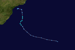
| Tropical storm (SSHWS) |
|
|
| Duration |
April 10, 1991 – April 14, 1991 |
| Peak intensity |
65 km/h (40 mph) (1-min) |
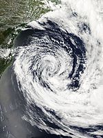
| Category 2 hurricane (SSHWS) |
|
|
| Duration |
March 24, 2004 – March 28, 2004 |
| Peak intensity |
155 km/h (100 mph) (1-min) 972 hPa (mbar) |
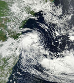
| Tropical storm (SSHWS) |
|
|
| Duration |
March 8, 2010 – March 12, 2010 |
| Peak intensity |
85 km/h (50 mph) (1-min) 995 hPa (mbar) |
| Subtropical storm (SSHWS) |
|
|
| Duration |
March 14, 2011 – March 16, 2011 |
| Peak intensity |
85 km/h (50 mph) (1-min) 989 hPa (mbar) |
| Subtropical storm (SSHWS) |
|
|
| Duration |
February 5, 2015 – February 8, 2015 |
| Peak intensity |
65 km/h (40 mph) (1-min) 992 hPa (mbar) |
| Subtropical storm (SSHWS) |
|
|
| Duration |
March 10, 2015 – March 13, 2015 |
| Peak intensity |
65 km/h (40 mph) (1-min) 998 hPa (mbar) |
| Subtropical storm (SSHWS) |
|
|
| Duration |
November 15, 2016 – November 16, 2016 |
| Peak intensity |
75 km/h (45 mph) (1-min) 998 hPa (mbar) |
| Subtropical storm (SSHWS) |
|
|
| Duration |
December 4, 2016 – December 6, 2016 |
| Peak intensity |
100 km/h (65 mph) (1-min) 992 hPa (mbar) |
South Atlantic tropical cyclones are unusual weather events that occur in the Southern Hemisphere. Strong wind shear, which disrupts the formation of cyclones, as well as a lack of weather disturbances favorable for development in the South Atlantic Ocean make any strong tropical system extremely rare, and Catarina in 2004 was the only recorded South Atlantic hurricane in history. Those storms have only developed during the months from November through to April in this basin. Since 2011, the Brazilian Navy Hydrographic Center has started to assign names to tropical and subtropical systems in this basin, when they have sustained wind speeds of at least 65 km/h (40 mph), the generally accepted minimum sustained wind velocity for a disturbance to be designated as a tropical storm in the North Atlantic basin. Below is a list of notable South Atlantic tropical and subtropical cyclones.
Until April 1991 it was thought that tropical cyclones did not develop within the South Atlantic. Very strong vertical wind shear in the troposphere is considered a deterrent. The Intertropical Convergence Zone drops one to two degrees south of the equator, not far enough from the equator for the Coriolis force to aid development. Water temperatures in the tropics of the southern Atlantic are cooler than those in the tropical north Atlantic.
During April 1991, these assertions were proven false when the United States National Hurricane Center reported that a tropical cyclone had developed over the Eastern Atlantic. In subsequent years, a few systems were suspected to have the characteristics needed to be classified as a tropical cyclone including in March 1994 and January 2004. During March 2004, an extratropical cyclone formally transitioned into a tropical cyclone and made landfall on Brazil, after becoming a Category 2 hurricane on the Saffir-Simpson hurricane wind scale. While the system was threatening the Brazilian state of Santa Catarina, a newspaper used the headline "Furacão Catarina," which was originally presumed to mean "furacão (hurricane) threatening (Santa) Catarina (the state)". After international presses started monitoring the system, "Hurricane Catarina" has formally been adopted.
...
Wikipedia


