Snow Island (South Shetland Islands)

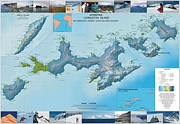
Topographic map of Livingston Island, Greenwich, Robert, Snow and Smith Islands.
|
|
| Location in Antarctica | |
| Geography | |
|---|---|
| Location | Antarctica |
| Coordinates | 62°47′S 61°23′W / 62.783°S 61.383°WCoordinates: 62°47′S 61°23′W / 62.783°S 61.383°W |
| Archipelago | South Shetland Islands |
| Area | 120.4 km2 (46.5 sq mi) |
| Length | 16 km (9.9 mi) |
| Width | 8 km (5 mi) |
| Administration | |
|
None
|
|
| Demographics | |
| Population | Uninhabited |
| Additional information | |
| Administered under the Antarctic Treaty System | |
Snow Island or Isla Nevada is a completely ice-covered island, 16 by 8 kilometres (9.9 by 5.0 mi) in size, lying 6 kilometres (3.7 mi) southwest of Livingston Island in the South Shetland Islands. Surface area 120.4 square kilometres (46.5 sq mi). This island was known to both American and British sealers as early as 1820, and the name has been well established in international usage for over 100 years.
...
Wikipedia

