Skardsøya
|
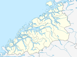
Location in Møre og Romsdal
|
|
| Geography | |
|---|---|
| Location | Nordmøre, Norway |
| Coordinates | 63°21′50″N 8°33′57″E / 63.3640°N 8.5658°ECoordinates: 63°21′50″N 8°33′57″E / 63.3640°N 8.5658°E |
| Area | 52.3 km2 (20.2 sq mi) |
| Length | 8 km (5 mi) |
| Width | 12.5 km (7.77 mi) |
| Highest elevation | 390 m (1,280 ft) |
| Highest point | Bjørnskardliknubben |
| Administration | |
| County | Møre og Romsdal |
| Municipality | Aure Municipality |
Skardsøya is an island in Aure Municipality in Møre og Romsdal county, Norway. It is located along the Trondheimsleia strait in the northeastern part of Aure, just east of the island of Grisvågøya and north and west of the mainland. The island is connected to the mainland to the east by the Dromnessund Bridge and to the south by the Torsetsund Bridge.
...
Wikipedia

