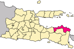
Situbondo Regency
|
Situbondo Regency (Kabupaten Situbondo) |
|
|---|---|
| Regency | |
 Situbondo Regency in East Java province |
|
| Coordinates: 7°42′S 114°00′E / 7.700°S 114.000°ECoordinates: 7°42′S 114°00′E / 7.700°S 114.000°E | |
| Country |
|
| Province | East Java |
| Area | |
| • Total | 1,669.87 km2 (644.74 sq mi) |
| Population (2014)estimate | |
| • Total | 665,818 |
| • Density | 400/km2 (1,000/sq mi) |
Situbondo Regency is a regency (kabupaten) of East Java province, Indonesia. It covers an area of 1,669.87 km2, and had a population of 647,619 at the 2010 Census; the latest official estimate (as at January 2014) is 665,818. It is located in east end of Java before Banyuwangi. The administrative centre is Situbondo, a small town within the regency. One of the famous tourist sites is the white sand beach.
Situbondo Harbor, situbondo has three harbor 1. Panarukan Harbor, 2. Kalbut Harbor in semiring districts of mangaran and 3. jangkar Harbor in asembagus
Two groups of men under a large banyan tree in Situbondo
River and washed away bridge in the area of Situbondo
...
Wikipedia
