Sint Eustatius
| Sint Eustatius | |||
|---|---|---|---|
| Special municipality of the Netherlands | |||
|
|||

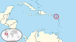
Location of Sint Eustatius (circled in red)
in the Caribbean (light yellow) |
|||
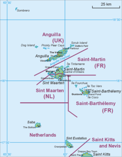
 Map showing location of St. Eustatius relative to Saba and St. Martin. |
|||
| Coordinates: 17°29′N 62°59′W / 17.483°N 62.983°W | |||
| Country | Netherlands | ||
| Incorporated into the Netherlands | 10 October 2010 (dissolution of the Netherlands Antilles) | ||
| Capital (and largest city) |
Oranjestad | ||
| Government (see Politics of the Netherlands) | |||
| • Lt. Governor | Julian Woodley (Acting) | ||
| Area | |||
| • Total | 32 km2 (12 sq mi) | ||
| Population (December 2013) | |||
| • Total | 4,020 | ||
| • Density | 130/km2 (330/sq mi) | ||
| Demonym(s) | St. Eustatian | ||
| Languages | |||
| • Official | Dutch | ||
| • Recognised regional | English | ||
| Time zone | AST (UTC−4) | ||
| Calling code | +599-3 | ||
| ISO 3166 code | BQ-SE, NL-BQ3 | ||
| Currency |
US dollar (USD) |
||
| Internet TLD | .an,.nl | ||
in the Caribbean (light yellow)
Sint Eustatius (Dutch pronunciation: [sɪnt øsˈtaːtsiʏs]), also known affectionately to the locals as Statia (/ˈsteɪʃə/), is part of the Caribbean Netherlands: i.e. it is a Caribbean island and a special municipality (officially “public body”) of the Netherlands.
The island lies in the northern Leeward Islands portion of the West Indies, southeast of the Virgin Islands. Sint Eustatius is immediately to the northwest of Saint Kitts, and to the southeast of Saba. The regional capital is Oranjestad.
The island has an area of 21 square kilometres (8.1 sq mi). In the 2001 census, the population was recorded as 3,543 inhabitants, with a population density of 169 inhabitants per square kilometre. As of 2015[update], the population was officially estimated at 3,877. The official language is Dutch, but English is the "language of everyday life" on the island and education is solely in English. A local English-based creole is also spoken informally. Travellers to the island by air arrive through F.D. Roosevelt Airport.
...
Wikipedia


