Simpson, LA
| Simpson, Louisiana | |
| Village | |
| Country | United States |
|---|---|
| State | Louisiana |
| Parish | Vernon |
| Elevation | 259 ft (78.9 m) |
| Coordinates | 31°15′22″N 93°01′07″W / 31.25611°N 93.01861°WCoordinates: 31°15′22″N 93°01′07″W / 31.25611°N 93.01861°W |
| Area | 6.2 sq mi (16.1 km2) |
| - land | 6.2 sq mi (16 km2) |
| - water | 0.0 sq mi (0 km2), 0% |
| Population | 583 (2000) |
| Density | 93.9/sq mi (36.3/km2) |
| Mayor | Donnis Brinkley (elected 2012) Police Chief David Delrie (R) (elected 2013) |
| Timezone | CST (UTC-6) |
| - summer (DST) | CDT (UTC-5) |
| Area code | 337 |
|
Location in Vernon Parish and the state of Louisiana.
|
|
|
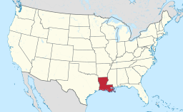
Location of Louisiana in the United States
|
|
Police Chief David Delrie (R) (elected 2013)
Simpson is a village in Vernon Parish, Louisiana, United States. The population was 583 at the 2000 census. It is part of the Fort Polk South Micropolitan Statistical Area.
Simpson is located at 31°15′22″N 93°1′7″W / 31.25611°N 93.01861°W (31.256010, -93.018519).
According to the United States Census Bureau, the village has a total area of 6.2 square miles (16 km2), of which 6.2 square miles (16 km2) is land and 0.16% is water.
This climatic region is typified by hot, humid summers and mild winters. According to the Köppen Climate Classification system, Simpson has a humid subtropical climate, abbreviated "Cfa" on climate maps.
As of the census of 2000, there were 583 people, 234 households, and 175 families residing in the village. The population density was 93.9 inhabitants per square mile (36.2/km²). There were 267 housing units at an average density of 43.0 per square mile (16.6/km²). The racial makeup of the village was 94.34% White, 0.69% African American, 4.63% Native American, and 0.34% from two or more races. Hispanic or Latino of any race were 1.54% of the population.
...
Wikipedia


