Silverthorne, Colorado
| Silverthorne, Colorado | |
|---|---|
| Town | |

Silverthorne seen from Ptarmigan Peak. In the background Buffalo Mountain is on the left, while Red Mountain and Mount Silverthorne are located adjacent to each other to the right.
|
|
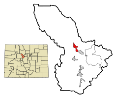
 Location in Summit County and the state of Colorado |
|
| Coordinates: 39°38′18″N 106°4′35″W / 39.63833°N 106.07639°WCoordinates: 39°38′18″N 106°4′35″W / 39.63833°N 106.07639°W | |
| Country |
|
| State |
|
| County | Summit County |
| Incorporated | September 5, 1967 |
| Government | |
| • Type | Home Rule Municipality |
| Area | |
| • Total | 3.2 sq mi (8.3 km2) |
| • Land | 3.2 sq mi (8.2 km2) |
| • Water | 0 sq mi (0.1 km2) |
| Elevation | 9,035 ft (2,754 m) |
| Population (2010) | |
| • Total | 3,887 |
| Time zone | Mountain (MST) (UTC-7) |
| • Summer (DST) | MDT (UTC-6) |
| ZIP codes | 80497 (Post-office box), 80498 |
| Area code(s) | 970 |
| FIPS code | 08-70525 |
| GNIS feature ID | 0204668 |
| Website | Town of Silverthorne |
Silverthorne is a Home Rule Municipality that is the second most populous town in Summit County, Colorado. According to 2010 Census, the population of the city is 3,887.
The town was named for Judge Marshall Silverthorn who served as the judge of the miner's court in Breckenridge. The judge first came to town as a prospector and claimed a section of the Blue River in 1881. After patenting his claim in April 1882, he was disappointed to find the gold to be sparse and the claim a poor bet. The land passed to his daughters on his death in 1887 and was then sold several times to various mining companies. In 1953, Clayton Hill bought the property and subdivided it for homes and stores.
Silverthorne served as a makeshift camp for workers during the construction of the Dillon Reservoir from 1961-1963, and later as a stop along Interstate 70. It was eventually incorporated on April 5, 1967.
The city has expanded several times since incorporation by annexation.
Silverthorne is located at 39°38′18″N 106°04′35″W / 39.638391°N 106.076505°W, at 8,730 feet above sea level (2661 meters). The town is situated between the Gore Range to the west and the Continental Divide to the east. The two most visible mountains are Buffalo and Red Mountains. Also surrounding the valley are Ptarmigan, Tenderfoot, and Ten Mile Peaks.
According to the United States Census Bureau, the town has a total area of 3.2 square miles (8.3 km2), of which, 3.2 square miles (8.3 km2) of it is land and 0.04 square miles (0.10 km2) of it (0.94%) is water.
Silverthorne has a highland-influenced humid continental climate (Köppen (Dfb) with warm summer days, cold nights year round, as well as cold and snowy winter days.
...
Wikipedia
