Short Drop Cave - Gavel Pot System
| Short Drop Cave - Gavel Pot system | |
|---|---|
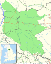
| Location | Leck Fell, Lancashire, England |
| OS grid | SD 67026892 |
| Coordinates | 54°12′18″N 2°30′25″W / 54.205079°N 2.506952°WCoordinates: 54°12′18″N 2°30′25″W / 54.205079°N 2.506952°W |
| Depth | 212 metres (696 ft) |
| Length | about 3.5 kilometres (2.2 mi) |
| Elevation | 323 metres (1,060 ft) |
| Discovery | 1885 |
| Geology | Carboniferous limestone |
| Entrances | 4 |
| Hazards | verticality, water |
| Access | CNCC Permit |
Short Drop Cave and Gavel Pot are different entrances into the same cave system on Leck Fell, in Lancashire, England. The main top entrance, Short Drop Cave, is a small hole in a fenced off shakehole near the main stream sink; Gavel Pot, a window into the system, is a large fenced shakehole some 40-metre (130 ft) deep requiring tackle to descend. There are two other smaller entrances into Short Drop Cave. At it base the system links via a sump with Lost Johns' Cave, and is part of the Three Counties System, an 87 kilometres (54 mi) cave system which spans the borders of Cumbria, Lancashire, and North Yorkshire.
The main entrance into Short Cave is at the end of a shallow valley where a small hole drops into a stream passage. Upstream leads to a canal passage which becomes too tight, although an excavated squeeze on the right before the end leads to the Coal Hole entrance. Downstream, 100 metres (330 ft) of mainly low passage leads to an oxbow with a larger passage arriving from Rift Entrance. A long awkward inlet passage called Masochist Passage can be followed to the north-east for some 300 metres (980 ft) almost up to the Rumbling Hole stream sinks, and an old high level route named Ancient Highway loops back to the main route.
Downstream continues as a canyon passage which steadily enlarges, passing an inlet passage on the left where the main water enters which can be followed up to where it becomes choked with boulders underneath the stream sink. The main passage continues for about 300 metres (980 ft) up to 15 metres (49 ft) high and 5 metres (16 ft) wide, under a boulder bridge wedged across the passage, to finish in a choke in a roof chamber. The water then follows a narrow meandering canyon to the first waterfall pitch of 5 metres (16 ft), and continues to a second pitch of 8 metres (26 ft) at the base of which the water disappears into a choked sump pool. A traverse can be followed over the top of the pitch round to where a pitch enters from the Gavel Pot doline.
Rift Entrance (54°12′16″N 2°30′25″W / 54.204478°N 2.506837°W) is a currently blocked entrance just over the wall from the main sink. A climb down enters a rift chamber, where a passage enters the First Oxbow in Short Drop Cave.
...
Wikipedia

