Sheerwater
| Sheerwater | |
|---|---|
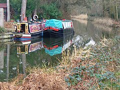
 Boats on the Basingstoke Canal |
|
 A small part of Albert Drive with high pines, long-established in the soil type, see Bagshot Formation. |
|
| Sheerwater shown within Surrey | |
| Population | 3,603 |
| OS grid reference | TQ0260 |
| District | |
| Shire county | |
| Region | |
| Country | England |
| Sovereign state | United Kingdom |
| Post town | Woking |
| Postcode district | GU22 |
| Dialling code | 01932 |
| Police | Surrey |
| Fire | Surrey |
| Ambulance | South East Coast |
| EU Parliament | South East England |
| UK Parliament | |
Sheerwater is a residential neighbourhood or small suburb of the Borough of Woking in Surrey, England, with a shared place of worship and occasionally described as a village, between West Byfleet and Horsell. Its border is defined to the north by a gently winding part of the Basingstoke Canal and to the south by the South Western Main Line which passes from cutting level to that of an embankment. The neighbourhood has some commerce and industry to its south, is linear, includes diverse green spaces to north and south and covers 0.92 square kilometres (0.36 sq mi) or 92 hectares (230 acres). Three teenage residents formed the band The Jam in the 1970s while attending Sheerwater's secondary school including Paul Weller – the remainder of the band he led also attended the school.
Sheerwater was also spelt Sherewater until the early 20th century. It was since the Norman Conquest a high sandy heath and notable pond (small lake) of Pyrford. Sherewater Pond, on the borders of Pyrford and of Chertsey parishes, was an extensive mere on the high Bagshot Sand, drained and planted at the time of its enclosure, 29 September 1815. Under this process it was allocated into private hands from public common land; a farm was created. John Aubrey then Edward Brayley confused Sherewater with a pond by the Guildford road (A3) on Wisley Common, drained by Peter King, 7th Baron King the Whig politician and writer rather earlier. Sherewater Pond is marked on John Rocque's map (an 18th-century cartographer).
...
Wikipedia

