Semmering Pass
| Semmering | |
|---|---|

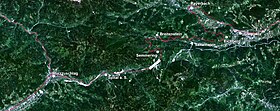
Satellite photo of the Semmering
|
|
| Elevation | 965 m (3,166 ft) |
| Location | Austria |
| Range | Alps |
| Coordinates | 47°37′57″N 15°49′47″E / 47.63250°N 15.82972°ECoordinates: 47°37′57″N 15°49′47″E / 47.63250°N 15.82972°E |
|
Location of Semmering Pass
|
|
For the town of the same name, see Semmering, Austria.
Semmering (German pronunciation: [ˈzɛməʁɪŋ]) is a mountain pass in the Eastern Northern Limestone Alps connecting Lower Austria and Styria, between which it forms a natural border.
Semmering Pass is located west of Sonnwendstein and Hirschenkogel and east of the Pinkenkogel.
With the Wechsel Pass, the Semmering is the most important connection between Lower Austria and Styria. It can be crossed by road (via an Autobahn with a tunnel), or using the Semmering Railway.
A village also bearing the name Semmering is located on the pass. The villages of Maria Schutz and Spital am Semmering are located slightly below the pass, on the Lower Austrian and Styrian sides respectively. Schottwien and Mürzzuschlag are the closest sizeable towns on either side.
As the Semmering is a major bottleneck in the Austrian railway network, the Semmering Railway, which is a UNESCO World Heritage site, is planned to be supplemented by a tunnel located at the base of the mountains. The project is supported by the Austrian Federal Government and the governments of Styria and Carinthia, but has been heavily opposed by the government of Lower Austria, which stalled the project by issuing negative environmental impact statements. The project has now been revised according to the advanced state of technology and the layout of the line has been altered in order to minimize effects on ground water.
...
Wikipedia

