Selbsanft
| Selbsanft | |
|---|---|

To the left the 2750 m high Vorder Selbsanft, also known as Hauserhorn, from the upper Linth Valley. Tödi (middle) in the far back with the prominent summit Sandgipfel (right, 3389 m) and Glarner Tödi (left, 3571 m). And to the right the 2644 m Zuetribistock.
|
|
| Highest point | |
| Peak | Hinderi Schibe |
| Elevation | 3,083 m (10,115 ft) |
| Prominence | 180 m (590 ft) |
| Parent peak | Tödi |
| Coordinates | 46°49′54.1″N 8°58′41.6″E / 46.831694°N 8.978222°ECoordinates: 46°49′54.1″N 8°58′41.6″E / 46.831694°N 8.978222°E |
| Geography | |
| Country | Switzerland |
| Canton | Glarus |
| Parent range | Glarus Alps |
| Topo map | Swiss Federal Office of Topography swisstopo |
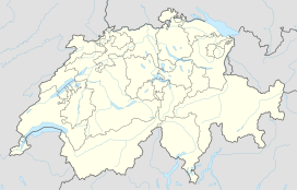
The Selbsanft is a mountain massif in the Glarus Alps, overlooking the village of Linthal in the canton of Glarus. The Selbsanft is a large mountain massif consisting of several summits of which the highest is named Hideri Schibe. The massif is a buttress of the and forms, along with Schiben, the ridge that separates the valleys of the Sand (west) and Limmernsee (east). A small glacier lies east of the summit.
The five main summits are, from north to south, the Vorder Selbsanft, also known as Hauserhorn (2,750 metres (9,022 ft), there are higher summits between the Vorder and Mittler Selbsanft, though), Mitttler Selbsanft, also known in Grison as Plattas Alvas (2,949 metres (9,675 ft)), the Hinter Selbsanft (3,028 metres (9,934 ft)), the highest peak of the Selbsanft triple. In a broader sense, the Vorderi Schibe (2,987 metres (9,800 ft)) and the Hinderi Schibe (3,083 metres (10,115 ft)), the highest summit of this massif, re also part of the massif.
The mountain lies within the municipality of Glarus Süd.
...
Wikipedia

