Sawmill Brook
| Sawmill Brook | |
|---|---|

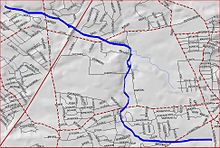
Sawmill Brook map
|
|
| Country | United States |
| Physical characteristics | |
| Main source | 40°26′35″N 74°23′58″W / 40.44306°N 74.39944°W |
| River mouth | 20 ft (6.1 m) 40°27′34″N 74°25′53″W / 40.45944°N 74.43139°WCoordinates: 40°27′34″N 74°25′53″W / 40.45944°N 74.43139°W |
| Basin features | |
| Progression | Lawrence Brook, Raritan River, Atlantic Ocean |
Sawmill Brook is a tributary of Lawrence Brook in northwestern East Brunswick, New Jersey in the United States.
The Sawmill Brook's official source is at 40°26′35″N 74°23′58″W / 40.44306°N 74.39944°W. It runs through the industrialized section between Harts Lane and Route 18. It then crosses Harts Lane and runs through Tices Lane Park. Another branch from the south joins it, and it crosses Tices Lane. It crosses the New Jersey Turnpike and Ryders Lane, and drains into Westons Mill Pond, a dammed section of Lawrence Brook, at 40°27′34″N 74°25′53″W / 40.45944°N 74.43139°W.
Sawmill Brook runs through heavily populated areas, so it is easy to access.
...
Wikipedia
