Savanna Portage State Park
| Savanna Portage State Park | |
| Minnesota State Park | |
|
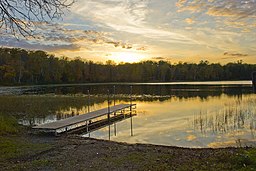
The boat launch on Lake Shumway
|
|
| Country | United States |
|---|---|
| State | Minnesota |
| Counties | Aitkin, Saint Louis |
| Location | McGregor, Minnesota |
| - elevation | 1,280 ft (390 m) |
| - coordinates | 46°50′15″N 93°9′24″W / 46.83750°N 93.15667°WCoordinates: 46°50′15″N 93°9′24″W / 46.83750°N 93.15667°W |
| Area | 15,200 acres (6,200 ha) |
| Founded | 1961 |
| Management | Minnesota Department of Natural Resources |
|
Savanna Portage
|
|

The Savanna Portage originally crossed this marsh without benefit of this modern boardwalk
|
|
| Location | Balsam Township, Minnesota |
|---|---|
| Area | 3,200 acres (1,300 ha) |
| NRHP Reference # | 73000963 |
| Added to NRHP | April 23, 1973 |
Savanna Portage State Park is a state park of Minnesota, USA, established in 1961 to preserve the historic Savanna Portage, a difficult 6-mile (9.7 km) trail connecting the watersheds of the Mississippi River and Lake Superior. The park contains a drainage divide separating the West Savanna River, which drains to the Mississippi River and the Gulf of Mexico, from the East Savanna River, which flows in an opposite direction to the Saint Louis River, Lake Superior and the Great Lakes, and the Saint Lawrence River to the Atlantic Ocean.
Savanna Portage was a canoe portage used by Native Americans for centuries before being used by European explorers, fur traders, Voyageurs, coureurs des bois, and missionaries of the 18th and 19th centuries. It was a vital link connecting the Mississippi waterways to the west with the Great Lakes to the east. The portage was listed on the National Register of Historic Places in 1973 for having state-level significance in the themes of commerce, exploration/settlement, and transportation. The park which now contains it is located 17 miles (27 km) north and east of McGregor, Minnesota, and approximately 50 miles (80 km) west of Duluth.
The park is located on the divide between the watersheds of the Great Lakes and the Gulf of Mexico, both of which drain to the Atlantic Ocean. The area is a low-relief plain which was once a glacial lakebed. During the last phase of the Wisconsinan glaciation, the deteriorating continental glacier left behind connected lakes, known as Glacial Lakes Aitkin and Upham. Formed by the retreat of the Saint Louis Sublobe of the Superior Lobe of the glacier, Lake Upham drained through Lake Aitkin to the Mississippi River. The retreating glacier and the lakes deposited sand and sediments in the lakebed. As the lakes drained these sediments became the present plain.
...
Wikipedia


