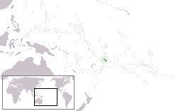
Savai'i
| Nickname: Soul of Samoa | |
|---|---|

Map of Savai'i
|
|
 |
|
| Geography | |
| Location | Pacific Ocean |
| Coordinates | 13°35′S 172°25′W / 13.583°S 172.417°W |
| Archipelago | Samoa Islands |
| Area | 1,694 km2 (654 sq mi) |
| Length | 70 km (43 mi) |
| Width | 46 km (28.6 mi) |
| Highest elevation | 1,858 m (6,096 ft) |
| Highest point | Mt Silisili (1,858m) |
| Administration | |
| Demographics | |
| Population | 43,142 (2006) |
| Pop. density | 25 /km2 (65 /sq mi) |
| Ethnic groups | 92.6% Samoans, 7% Euronesians (persons of European and Polynesian blood), 0.4% Europeans |
Savaiʻi is the largest (area 1700 km2) and highest (Mt Silisili at 1,858 m) island in Samoa and the Samoa Islands chain. The island is the fifth largest in Polynesia, behind the two main islands of New Zealand and the Hawaiian Islands of Hawaii and Maui.
The island of Savai'i is also referred to by Samoans as Salafai, a classical Samoan term used in oratory and prose. The island is home to 43,142 people (2006 Census) who make up 24% of the country's population. The only township and ferry terminal is Salelologa, the main entry point to the island, situated at the east end of Savai'i. A tar sealed road serves as the one main highway, connecting most of the villages with local buses reaching most settlements.
Savai'i is made up of six itūmālō (political districts). Each district is made up of villages with strong traditional ties of kinship, history, land and matai chief titles. There is also some limited ecotourism development which operates mostly within the villages. The Mau, Samoa's non-violent movement for political independence during colonialism in the early 1900s, had its beginnings on Savai'i with the Mau a Pule movement.
...
Wikipedia
