Satawal

Satawal Atoll
|
|
 |
|
| Geography | |
|---|---|
| Location | North Pacific |
| Coordinates | 7°21′28″N 147°02′14″E / 7.3579°N 147.0373°E |
| Archipelago | Caroline |
| Total islands | 1 |
| Area | 1.3 km2 (0.50 sq mi) |
| Highest elevation | 2 m (7 ft) |
| Administration | |
| Demographics | |
| Population | 500 (2000) |
| Ethnic groups | Micronesian |
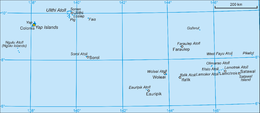
Satawal is a solitary coral atoll of one island with about 500 people on just over 1 km2 located in the Caroline Islands in the Pacific Ocean It forms a legislative district in Yap State in the Federated States of Micronesia. Satawal is the easternmost island in the Yap island group and is located approximately 70 kilometres (43 mi) east of Lamotrek.
The island, which measures 2 kilometres (1.2 mi) long northeast-southwest, is up to 0.8 kilometres (0.50 mi) wide and sits atop a small platform-like reef with a narrow fringing reef. The total land area is 1.3 square kilometres (0.50 sq mi), and is thickly wooded with coconut and breadfruit trees. As there are no anchorages for large boats, Satawal is seldom visited by outsiders. Administratively Piagailoe Atoll, located 71 kilometers to the northwest, belongs to Satawal municipality.
The native language is Satawalese, a Trukic language closely related to Woleaian, and the entire population of the island numbers approximately 500. Although located in Yap State, the people of Satawal are more closely related, culturally and linguistically, to those of Chuuk.
The Satawalese primarily subsist on fishing and some agriculture (coconuts, breadfruit, taro). They build small thatch houses for sleeping and use the trunks of breadfruit trees for boat-building. Cultural forms primarily revolve around dance and story-telling, and an alcoholic beverage known as tuba (a palm wine) is brewed from fermented coconut milk.
As with all of the Caroline Islands, sovereignty passed from Spain to the Empire of Germany in 1899. The island came under the control of the Empire of Japan after World War I, and was subsequently administered under the South Pacific Mandate. Following World War II, the island came under the control of the United States of America and was administered as part of the Trust Territory of the Pacific Islands from 1947, and became part of the Federated States of Micronesia from 1979.
...
Wikipedia
