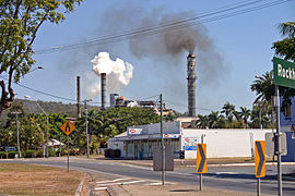
Sarina, Queensland
|
Sarina Queensland |
|||||||||||||
|---|---|---|---|---|---|---|---|---|---|---|---|---|---|
 |
|||||||||||||
| Coordinates | 21°25′S 149°13′E / 21.417°S 149.217°ECoordinates: 21°25′S 149°13′E / 21.417°S 149.217°E | ||||||||||||
| Population | 5,730 (2011 census) | ||||||||||||
| Postcode(s) | 4737 | ||||||||||||
| Location |
|
||||||||||||
| LGA(s) | Mackay Regional Council | ||||||||||||
| State electorate(s) | Mirani | ||||||||||||
| Federal Division(s) | Capricornia | ||||||||||||
|
|||||||||||||
Sarina /səˈriːnə/ is a town and locality in the Mackay Region, Queensland, Australia. In the 2011 census, Sarina had a population of 5,730 people.
Sarina lies just inland of the east coast of Queensland, 34 kilometres (21 mi) south of the city of Mackay, and approximately 300 kilometres (190 mi) north of the city of Rockhampton. The Bruce Highway passes through the locality from south to north, as does the North Coast railway line.
The town of Sarina is located on Plane Creek, which flows into the Coral Sea, but most of the urban development is on the northern side of the creek. The Bruce Highway and the railway line pass through the town, which is served by the Sarina railway station.
The neighbourhood of Oonooie lies 6.8 km south of the town (21°28′00″S 149°13′59″E / 21.46667°S 149.23306°E) and is the name of a former railway station on the North Coast line, which was named on 29 April 1915, reportedly after a principal clanswoman of that area.
...
Wikipedia

