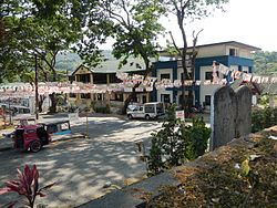
Santol, La Union
| Santol | ||
|---|---|---|
| Municipality | ||
 |
||
|
||
| Motto: Isem Metru Santol | ||
 Map of La Union showing the location of Santol |
||
| Location within the Philippines | ||
| Coordinates: 16°46′N 120°27′E / 16.77°N 120.45°ECoordinates: 16°46′N 120°27′E / 16.77°N 120.45°E | ||
| Country |
|
|
| Region | Ilocos (Region I) | |
| Province | La Union | |
| District | 1st District | |
| Barangays | 11 | |
| Government | ||
| • Mayor | Daisy Sayangda Olivar | |
| Area | ||
| • Total | 93.70 km2 (36.18 sq mi) | |
| Population (2015 census) | ||
| • Total | 12,476 | |
| • Density | 130/km2 (340/sq mi) | |
| Time zone | PST (UTC+8) | |
| ZIP code | 2505 | |
| IDD : area code | +63 (0)72 | |
| Income class | 4th class | |
| Website | www |
|
Santol is a fourth class municipality in the province of La Union, Philippines. According to the 2015 census, it has a population of 12,476 people.
Santol is situated in the north-eastern part of the Province of La Union. It is bounded on the north by the Municipality of Sudipen, on the north-east by the upland Municipality of Sugpon in Ilocos Sur, on the south by the Municipality of San Gabriel, and on the west by the Municipality of Balaoan. The town center of Santol is 40 kilometres (25 mi) north of the City of San Fernando, the provincial capital and regional administrative center; 310 kilometres (190 mi) north of Manila and 113 kilometres (70 mi) of the country's summer capital Baguio City via the Naguilian Road.
Santol is politically subdivided into 11 barangays.
Barangay (with Land Area (has))
In the 2015 census, the population of Santol, La Union, was 12,476 people, with a density of 130 inhabitants per square kilometre or 340 inhabitants per square mile.
Welcome arch
Municipal hall
Town center
Street view and landscape
...
Wikipedia


