Sand to Snow National Monument
| Sand to Snow National Monument | |
|---|---|
|
IUCN category V (protected landscape/seascape)
|
|
 |
|
| Location | San Bernardino County, California, US |
| Coordinates | 34°05′N 116°41′W / 34.08°N 116.68°WCoordinates: 34°05′N 116°41′W / 34.08°N 116.68°W |
| Area | 154,000 acres (62,000 ha) |
| Authorized | February 12, 2016 |
| Governing body | Bureau of Land Management, National Forest Service |
| Website | Sand to Snow National Monument |
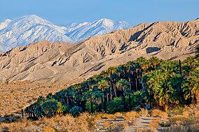
Sand to Snow National Monument is a U.S. National Monument located in San Bernardino County and into northern Riverside County, Southern California.
It protects diverse montane and desert habitats of the San Bernardino Mountains, southern Mojave Desert, and northwestern Colorado Desert.
The national monument protects a total of 154,000 acres (62,000 ha), with the Bureau of Land Management (BLM) managing 83,000 acres (34,000 ha) acres, and the USFS−San Bernardino National Forest managing 71,000 acres (29,000 ha). It extends from around 1,000 feet (300 m) on the Coachella Valley desert floor up to over 11,000 feet (3,400 m) in the San Bernardino Mountains.
Over 100,000 acres (40,000 ha) of the national monument are within the San Gorgonio Wilderness area, which was designated by Congress in 1964. An eastern border in the Little San Bernardino Mountains abuts Joshua Tree National Park. A separate section expands the Bighorn Mountain Wilderness area to the northeast.
30 miles (48 km) of the Pacific Crest National Scenic Trail pass through the monument. The headwaters of the Santa Ana River, Whitewater River, Morongo Creek, and San Gorgonio River are within it. The park protects a significant wildlife corridor and landscape linkage between the San Bernardino National Forest/San Gorgonio Wilderness area, Joshua Tree National Park, and Bighorn Mountain Wilderness area.
...
Wikipedia


