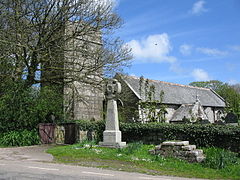
Sancreed
Sancreed
|
|
|---|---|
 Sancreed parish church |
|
| Sancreed shown within Cornwall | |
| Population | 649 (2011 census including Brane and Catchall) |
| OS grid reference | SW418293 |
| Civil parish |
|
| Unitary authority | |
| Ceremonial county | |
| Region | |
| Country | England |
| Sovereign state | United Kingdom |
| Post town | Penzance |
| Postcode district | TR19 |
| Dialling code | 01736 |
| Police | Devon and Cornwall |
| Fire | Cornwall |
| Ambulance | South Western |
| EU Parliament | South West England |
| UK Parliament | |
Sancreed (Cornish: Eglossankres) is a village and civil parish in Cornwall, England, UK. The village is situated approximately three miles (5 km) west of Penzance.
Sancreed civil parish encompasses the settlements of Bejouans, Bosvennen, Botreah, Drift, Sancreed Churchtown, Trenuggo, and Tregonnebris. It is bounded by St Just parish to the west, Madron parish to the northeast, and St Buryan and Paul parishes to the south. The parish comprises 4,608 acres (18.65 km2) of land including Drift Reservoir which provides drinking water for the area.
Sancreed in “PENWITH, THE LAST HUNDRED IN ENGLAND, IN THE HEART OF which lies Sancreed, is a land of stone circles and cave-dwellings, crosses and cromlechs, barrows and menhirs, Holy wells and ancient oratories. In no other part of the country are there so many relics of what is popularly called the prehistoric age. Myth and romance, legend and folklore gather about its grey stones. Where so much is hidden in the mists of antiquity, recourse must, on occasion, be had to conjecture in piecing together the story of the past.” (Anon).
Sancreed (Cornish: Eglossankres) is an inland parish in the Hundred of Penwith, about three miles from Penzance. The civil parish encompasses the settlements of Bejouans, Bosvennen, Botreath, Drift, Sancreed Churchtown, Trenuggo and Tregonnebris. It is bounded by St Just to the west, Madron parish to the north-east and St Buryan and Paul parishes to the south. Within the parish is a noteworthy prehistoric settlement at Carn Euny. A few hundred metres west of the church there is a holy well and baptistry, which predate the parish church. The parish comprises 4,608 acres of land wholly situated on granite and has, with a light loam, covering used chiefly for mixed agriculture, a population of 628 (2001), many of whom look outside of the parish for employment and the provision of commercial, recreational and social services.
...
Wikipedia

