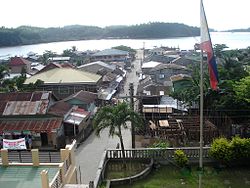
San Pascual, Masbate
| San Pascual | |
|---|---|
| Municipality | |
 |
|
 Map of Masbate with San Pascual highlighted |
|
| Location within the Philippines | |
| Coordinates: 13°08′N 122°59′E / 13.133°N 122.983°ECoordinates: 13°08′N 122°59′E / 13.133°N 122.983°E | |
| Country | Philippines |
| Region | Bicol (Region V) |
| Province | Masbate |
| District | 1st district |
| Barangays | 22 |
| Government | |
| • Mayor | Zacarina A. Lazaro |
| Area | |
| • Total | 246.65 km2 (95.23 sq mi) |
| Population (2010) | |
| • Total | 44,753 |
| • Density | 180/km2 (470/sq mi) |
| Time zone | PST (UTC+8) |
| Zip Code | 5420 |
| Dialing code | 56 |
San Pascual is a third class municipality in the province of Masbate, Philippines, located at the northernmost tip of Burias Island. According to the 2010 census, it has a population of 44,753 people. In addition to the northern part of Burias Island, the islands of Busing, Templo (or Iniwaran,) and another six very small unpopulated islands belong to the municipality.
San Pascual is politically subdivided into 22 barangays.
...
Wikipedia

