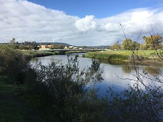
San Lorenzo River
| San Lorenzo River | |
| Rio de San Lorenzo | |
| stream | |
|
The San Lorenzo River southeast of downtown Santa Cruz.
|
|
| Country | United States |
|---|---|
| State | California |
| Region | Santa Clara County |
| Tributaries | |
| - left | Kings Creek, Bear Creek, Love Creek, Newell Creek, Zayante Creek, Powder Mill Creek, Branciforte Creek |
| - right | Boulder Creek, Fall Creek |
| Cities | Boulder Creek, Ben Lomond, Felton, Santa Cruz |
| Source | in the Santa Cruz Mountains |
| - location | Castle Rock State Park |
| - elevation | 2,670 ft (814 m) |
| - coordinates | 37°15′15″N 122°07′10″W / 37.25417°N 122.11944°W |
| Mouth | Monterey Bay |
| - location | Santa Cruz, California |
| - elevation | 0 ft (0 m) |
| - coordinates | 36°57′51″N 122°00′45″W / 36.96417°N 122.01250°WCoordinates: 36°57′51″N 122°00′45″W / 36.96417°N 122.01250°W |
The San Lorenzo River is a 29.3 miles (47.2 km) long river whose headwaters originate in Castle Rock State Park in the Santa Cruz Mountains and flow south by southeast through the San Lorenzo Valley before passing through Santa Cruz and emptying into Monterey Bay and the Pacific Ocean.
The first European land exploration of Alta California, the Spanish Portolà expedition, gave the river its name when it passed through the area on its way north, camping near the west bank on October 17, 1769. Franciscan missionary Juan Crespi, traveling with the expedition, noted in his diary that, "Not far from the sea we came to a large river...It is one of the largest that we have met with on the journey...This river was named San Lorenzo." "Not far from the sea" indicates that the party probably crossed the river at one of what later became the commonly used fords. The fords, in turn, became the locations for the first two bridges across the river - at today's Water Street and Soquel Avenue.
In 1863, the California Powder Works was built adjacent to the river three miles upstream from Santa Cruz. The powder works made gunpowder for California mining after normal supplies had been interrupted by the American Civil War. Upstream from the works, a dam was constructed (in what is now Henry Cowell Redwoods State Park) to raise the water level enough to flow into a 1200-foot-long tunnel, dug through a granite ridge to convey water to a raised flume that, with a 60-foot drop, provided water power for the powder mill machinery. During dry summer weather when the river was low, the total river flow might be diverted into the flume from below the dam. The powder mill was closed in 1914 and the dam demolished.
...
Wikipedia

