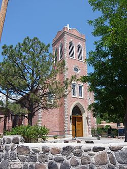
San Juan Indian Reservation
|
San Juan Pueblo
|
|

San Juan Bautista Church
|
|
| Nearest city | Santa Fe, New Mexico |
|---|---|
| Coordinates | 36°3′15″N 106°4′13″W / 36.05417°N 106.07028°WCoordinates: 36°3′15″N 106°4′13″W / 36.05417°N 106.07028°W |
| Area | 16.2 acres (6.6 ha) |
| Built | 1540 |
| NRHP Reference # | 74001201 |
| NMSRCP # | 254 |
| Significant dates | |
| Added to NRHP | July 30, 1974 |
| Designated NMSRCP | July 28, 1972 |
Ohkay Owingeh (pronounced [ˈokɛ oˈwiŋɛ]) is a pueblo and census-designated place in Rio Arriba County, New Mexico, United States of America. Its elevation is 5,663 feet (1,726 m) and it is located at 36°03′12″N 106°04′08″W / 36.05333°N 106.06889°W. One of its boundaries is contiguous with Española, about 25 miles (40 km) north of Santa Fe.
Ohkay Owingeh was previously known as San Juan Pueblo until returning to its pre-Spanish name in November 2005. The Tewa name of the pueblo means "place of the strong people".
Ohkay Owingeh has the ZIP code 87566 and the U.S. Postal Service prefers that name for addressing mail, but accepts the alternative name San Juan Pueblo. This ZIP Code Tabulation Area (ZCTA) had a population of 3,357 at the 2000 Census. The entire pueblo has a population of 6,748.
The pueblo was founded around 1200 AD during the Pueblo III Era. By tradition, the Tewa people moved here from the north, perhaps from the San Luis Valley of southern Colorado, part of a great migration spanning into the Pueblo IV Era.
...
Wikipedia

