San Jose International Airport
| Norman Y. Mineta San Jose International Airport | |||||||||||||||
|---|---|---|---|---|---|---|---|---|---|---|---|---|---|---|---|
 |
|||||||||||||||
 |
|||||||||||||||
| Summary | |||||||||||||||
| Airport type | Public | ||||||||||||||
| Owner | City of San Jose | ||||||||||||||
| Serves | San Jose | ||||||||||||||
| Location | San Jose, California, U.S. | ||||||||||||||
| Focus city for | |||||||||||||||
| Elevation AMSL | 62 ft / 19 m | ||||||||||||||
| Coordinates | 37°21′46″N 121°55′45″W / 37.36278°N 121.92917°WCoordinates: 37°21′46″N 121°55′45″W / 37.36278°N 121.92917°W | ||||||||||||||
| Website | www |
||||||||||||||
| Maps | |||||||||||||||
 FAA airport diagram |
|||||||||||||||
| Runways | |||||||||||||||
|
|||||||||||||||
| Statistics (2016) | |||||||||||||||
|
|||||||||||||||
|
Sources: airport web site,FAA Airport Master Record and FAA Passenger Boarding Data
|
|||||||||||||||
| Passengers | 10,796,725 |
|---|---|
| Aircraft operations | 138,915 |
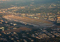
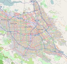
Norman Y. Mineta San Jose International Airport (IATA: SJC, ICAO: KSJC, FAA LID: SJC) is a city-owned public airport in San Jose, California, United States. It is named after San Jose native Norman Mineta, former Transportation Secretary in the Cabinet of George W. Bush and Commerce Secretary in the Cabinet of Bill Clinton. The name also recognizes Mineta's service as a councilman for, and mayor of, San Jose. It is a U.S. Customs and Border Protection international port of entry. It is three miles northwest of Downtown San Jose near the intersections of U.S. Route 101, Interstate 880, and State Route 87. The dominant carrier is Southwest Airlines with Alaska Airlines as the second largest. It also serves as a focus city for both Southwest Airlines and Alaska Airlines. The airport has free Wi-Fi in all terminals.
...
Wikipedia


