San Francisco Mountain
| San Francisco Peaks | |
|---|---|
| Dookʼoʼoosłííd (Navajo) Nuvatukya’ovi (Hopi) Wi:munakwa (Yavapai) |
|

The San Francisco Peaks viewed from atop nearby 9,000 ft Mount Elden
|
|
| Highest point | |
| Peak | Humphreys Peak |
| Elevation | 12,633 ft (3,851 m) |
| Coordinates | 35°20′47″N 111°40′40″W / 35.34639°N 111.67778°WCoordinates: 35°20′47″N 111°40′40″W / 35.34639°N 111.67778°W |
| Geography | |
| Country | United States |
| State | Arizona |
| Geology | |
| Type of rock | Igneous |
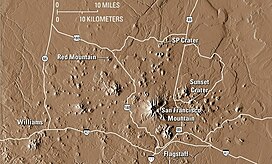
The San Francisco Peaks are a volcanic mountain range in north central Arizona, just north of Flagstaff and a remnant of the former San Francisco Mountain. The highest summit in the range, Humphreys Peak, is the highest point in the state of Arizona at 12,633 feet (3,851 m) in elevation. The San Francisco Peaks are the remains of an eroded stratovolcano. An aquifer within the caldera supplies much of Flagstaff's water while the mountain itself is in the Coconino National Forest, a popular recreation site. The Arizona Snowbowl ski area is on the western slopes of Humphreys Peak, and has been the subject of major controversy involving several tribes and environmental groups.
The six highest individual peaks in Arizona are contained in the range:
The mountain provides a number of recreational opportunities, including wintertime snow skiing and hiking the rest of the year. Hart Prairie is a popular hiking area and Nature Conservancy preserve located below the mountain's ski resort, Arizona Snowbowl.
Humphreys Peak (latitude 35°20'47" N) and Agassiz Peak (latitude 35°19'33" N) are the two farthest south-lying mountain peaks in the contiguous United States which rise to a height of more than 12,000 feet above sea level.
Prior to its collapse due to a lateral eruption to the northeast (around 200,000 years ago) and subsequent glacial erosion, the San Francisco Peaks fully matured elevation is estimated to have been around 16,000 feet.
In 1629, 147 years before San Francisco, California, received that name, Spanish friars founded a mission at a Hopi Indian village in honor of St. Francis, 65 miles from the peaks. Seventeenth century Franciscans at Oraibi village gave the name San Francisco to the peaks to honor St. Francis of Assisi, the founder of their order. The mountain man Antoine Leroux visited the San Francisco Peaks in the mid-1850s, and guided several American expeditions exploring and surveying northern Arizona. Leroux guided them to the only reliable spring, one on the western side of the peaks, which was later named Leroux Springs.
...
Wikipedia

