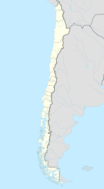
San Esteban, Chile
| San Esteban | ||||
|---|---|---|---|---|
| City and Commune | ||||
|
||||
| Coordinates: 32°47′57″S 70°34′49″W / 32.79917°S 70.58028°WCoordinates: 32°47′57″S 70°34′49″W / 32.79917°S 70.58028°W | ||||
| Country |
|
|||
| Region |
|
|||
| Province | Los Andes | |||
| Government | ||||
| • Type | Municipality | |||
| • Alcalde | René (Rana) Mardones Valencia (Ind.) | |||
| Area | ||||
| • Total | 1,361.6 km2 (525.7 sq mi) | |||
| Elevation | 831 m (2,726 ft) | |||
| Population (2012 Census) | ||||
| • Total | 17,090 | |||
| • Density | 13/km2 (33/sq mi) | |||
| • Urban | 7,542 | |||
| • Rural | 6,858 | |||
| Sex | ||||
| • Men | 7,298 | |||
| • Women | 7,102 | |||
| Time zone | CLT (UTC-4) | |||
| • Summer (DST) | CLST (UTC-3) | |||
| Area code(s) | 56 + 34 | |||
| Website | Municipality of San Esteban | |||
San Esteban ("St. Stephen" in Spanish) is a city and commune in the Los Andes Province of central Chile's Valparaíso Region. The commune spans an area of 1,361.6 km2 (526 sq mi).
According to the 2002 census of the National Statistics Institute, San Esteban spans an area of 1,361.6 km2 (526 sq mi) and has 14,400 inhabitants (7,298 men and 7,102 women). Of these, 7,542 (52.4%) lived in urban areas and 6,858 (47.6%) in rural areas. The population grew by 18.5% (2,247 persons) between the 1992 and 2002 censuses.
As a commune, San Esteban is a third-level administrative division of Chile administered by a municipal council, headed by an alcalde who is directly elected every four years. The 2008-2012 alcalde is René Mardones Valencia (Ind.).
Within the electoral divisions of Chile, San Esteban is represented in the Chamber of Deputies by Mr. Marco Antonio Núñez (PDC) and Mr. Gaspar Rivas (RN) as part of the 11th electoral district, (together with Los Andes, Calle Larga, Rinconada, San Felipe, Putaendo, Santa María, Panquehue, Llaillay and Catemu). The commune is represented in the Senate by Ignacio Walker Prieto (PDC) and Lily Pérez San Martín (RN) as part of the 5th senatorial constituency (Valparaíso-Cordillera).
...
Wikipedia


