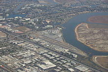
San Carlos Airport (California)
| San Carlos Airport | |||||||||||
|---|---|---|---|---|---|---|---|---|---|---|---|
 |
|||||||||||

FAA diagram
|
|||||||||||
| Summary | |||||||||||
| Airport type | Public | ||||||||||
| Owner | San Mateo County | ||||||||||
| Serves | San Carlos, California | ||||||||||
| Elevation AMSL | 5 ft / 2 m | ||||||||||
| Coordinates | 37°30′43″N 122°14′58″W / 37.51194°N 122.24944°WCoordinates: 37°30′43″N 122°14′58″W / 37.51194°N 122.24944°W | ||||||||||
| Runways | |||||||||||
|
|||||||||||
| Statistics (2007) | |||||||||||
|
|||||||||||
|
Source: Federal Aviation Administration
|
|||||||||||
| Aircraft operations | 155,273 |
|---|---|
| Based aircraft | 372 |
San Carlos Airport (IATA: SQL, ICAO: KSQL, FAA LID: SQL) is two miles northeast of San Carlos, California, in San Mateo County, California. The FAA's National Plan of Integrated Airport Systems (NPIAS) classifies San Carlos as a reliever airport for San Francisco International Airport.
The airport is off U.S. Route 101. The airport is home to Civil Air Patrol West Bay Composite Squadron 192. Next to the airport is the Hiller Air Museum.
The San Carlos Flying Field was established during World War I by J. Pauling Edwards on a five-acre field south of Cordilleras Creek. San Carlos' first pilot's certificate was issued on July 10, 1917 to Lieutenant Prince.
In 1923, the airfield was taken over by the Cooley family. Charles P. Cooley was the primary flight instructor in San Carlos at the time, after returning from battle. The airport itself was legally operated by Cooley's father, Frank S. Cooley. On July 12, 1940, a fire destroyed the main hangar and twelve aircraft. The family then vacated the property in 1935, closing the airport and the flight school and moving their operations to a new airfield near today's Twin Dolphin Drive in San Carlos. By March 1950, the airfield had a 200 ft by 2100 ft runway and a building for various industries on the airfield. However, the Cooley family soon regarded the airport as being inadequate due to its proximity to the Phelpes Slough and Steinberger Slough and poor ground conditions for a suitable runway. They opened another airfield at the present location of the San Carlos airport. By March 1952, the Cooley family transferred ownership of the airfield to Mr. Francis Michaud, who renamed it San Carlos-Belmont Airport. Many repair and administrative buildings were added along with plans to expand the runway up to 7000 ft in length. In 1957, the airport was renamed as San Mateo Country Airport, Inc. Ownership was also split between Michaud, the Piombo Construction Company and six other parties.
...
Wikipedia
