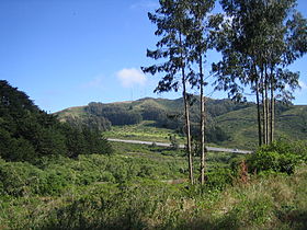
San Bruno Mountain
| San Bruno Mountain | |
|---|---|

View from San Bruno Mountain State Park
|
|
| Highest point | |
| Elevation | 1,319 ft (402 m) NAVD 88 |
| Prominence | 1,114 ft (340 m) |
| Coordinates | 37°41′15″N 122°26′08″W / 37.687440278°N 122.435555036°WCoordinates: 37°41′15″N 122°26′08″W / 37.687440278°N 122.435555036°W |
| Geography | |
| Location | San Mateo County, California, U.S. |
| Parent range | Santa Cruz Mountains |
| Topo map | USGS San Francisco South |
| Climbing | |
| Easiest route | Trail hike |
San Bruno Mountain is located in northern San Mateo County, California, with some slopes of the mountain crossing over into southern San Francisco. Most of the mountain lies within the 2,326-acre (941 ha) San Bruno Mountain State Park, a unique open-space island in the midst of the San Francisco Peninsula's urbanization. Next to the state park is the 83-acre (34 ha) state San Bruno Mountain Ecological Reserve on the north slope. It is near the southern boundary of San Francisco, surrounded by the cities of South San Francisco, Daly City, Colma, and Brisbane.
San Bruno Mountain is topped by a four mile long ridge. Trails to the summit afford expansive views of the San Francisco Bay Area. Radio Peak (elevation 1,319 feet or 402 metres) is the highest point, hosting several radio broadcast towers, KTSF television, ION's KKPX television and NBC's KNTV television, serving a huge area that would otherwise have poor service in the hilly Bay Area region.
The mountain provides habitat for several species of rare and endangered plants and butterflies. The endangered San Bruno elfin butterfly inhabits this mountain and a few other locations. The distinct Franciscan fog zone plants of San Bruno Mountain set it apart from other California coastal areas.
...
Wikipedia

