San Antonio, Chile
| San Antonio | |||||
|---|---|---|---|---|---|
| City and Commune | |||||

Panorama of the port of San Antonio, before the construction of a mall which obstructed the view of the port.
|
|||||
|
|||||
| Nickname(s): Principal Port (Puerto Principal) | |||||
| Coordinates (city): 33°35′36″S 71°37′18″W / 33.59333°S 71.62167°WCoordinates: 33°35′36″S 71°37′18″W / 33.59333°S 71.62167°W | |||||
| Country | Chile | ||||
| Region | Valparaíso | ||||
| Province | San Antonio | ||||
| Founded | 1894 | ||||
| Government | |||||
| • Type | Municipality | ||||
| • Alcalde | Omar Vera (2004-2008) | ||||
| Area | |||||
| • Total | 404.5 km2 (156.2 sq mi) | ||||
| Elevation | 4 m (13 ft) | ||||
| Population (2012 Census) | |||||
| • Total | 87,675 | ||||
| • Density | 220/km2 (560/sq mi) | ||||
| • Urban | 83,435 | ||||
| • Rural | 3,770 | ||||
| Demonym(s) | Sanantonian | ||||
| Sex | |||||
| • Men | 42,843 | ||||
| • Women | 44,362 | ||||
| Time zone | Chile Time (CLT) (UTC-4) | ||||
| • Summer (DST) | Chile Summer Time (CLST) (UTC-3) | ||||
| Area code(s) | +56 35 | ||||
| Climate | Csa | ||||
| Website | Official website (Spanish) | ||||
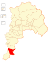
San Antonio is a Chilean city, commune and the capital of the San Antonio Province in the Valparaíso Region. It is the hub of the fishing area that spans the Chilean coast from Rocas de Santo Domingo to Cartagena. Its port is the largest in terms of freight handled and the busiest in the western coast of South America.
The city lies on hills and coastal dunes, immediately north of the mouth of the Maipo River and is crossed in two sections by estuaries, of Arévalo to the north and of El Sauce in the section of Llolleo.
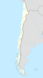
The city is located at 33°35′S and 71°37′W. It is bordered on the north by the commune of Cartagena; on the east, by the commune of Melipilla and the Maipo River; on the south, by the same river and by the communes of Santo Domingo and San Pedro; and on the west, by the Pacific Ocean (here termed "el mar Chileno", "the Chilean sea").
It comprises an area of 502.5 km2 (194 sq mi).
San Antonio enjoys a Mediterranean climate with coastal influences. The average annual temperature is 14 °C (57 °F) with averages of 19 °C (66 °F) in January and 8.2 °C (46.8 °F) in July. Annual precipitation of 570 mm (22 in) is concentrated in June, with an average of 134 mm (5 in).
Nomadic hunters and gatherers were the first inhabitants of Chilean territory. In this central coastal zone are evidences of ancient habitation extending back about thirteen thousand years.
The city was 80% destroyed by the 1985 Santiago earthquake.
The San Antonio port was shut down by the 27 February 2010 earthquake, but had resumed operation at 80% capacity by 3 March 2010. After the quake, only 5 of the 8 docking points at the port resumed operation.
...
Wikipedia


