Samui Island
|
Ko Samui เกาะสมุย |
|
|---|---|
| Island | |

Lipa Noi Beach
|
|
| Coordinates: 9°30′N 100°00′E / 9.500°N 100.000°ECoordinates: 9°30′N 100°00′E / 9.500°N 100.000°E | |
| Country | Thailand |
| Province | Surat Thani |
| Area | |
| • Total | 228.7 km2 (88.3 sq mi) |
| Highest elevation | 635 m (2,083 ft) |
| Lowest elevation | 0 m (0 ft) |
| Population (2012) | |
| • Total | 62,500 |
| • Density | 270/km2 (710/sq mi) |
| Time zone | ICT (UTC+7) |
| Country code | +66 |
Ko Samui (or Koh Samui, Thai: เกาะสมุย, pronounced [kɔ̀ʔ sā.mūj]) is an island off the east coast of the Kra Isthmus, Thailand. Geographically in the Chumphon Archipelago, it is part of Surat Thani Province, though as of 2012, Ko Samui was granted municipality status and thus is now locally self-governing. Ko Samui is Thailand's third largest island after Phuket and Ko Chang, with an area of 228.7 km2, a population of over 63,000 and a hotel occupancy rate of 73 percent as the number of visitors increases. Abundant tourist resources, sandy beaches, coral reefs, and coconut trees are present on the island.
The island was probably first inhabited about 15 centuries ago, settled by fishermen from the Malay Peninsula and southern China. It appears on Chinese maps dating back to 1687, under the name Pulo Cornam. The name samui is mysterious in itself. Perhaps it is an extension of the name of one of the native trees, mui. Some people believe that the word "samui" derives from the Malay word "saboey", or "safe haven", although there appears to be no credible corroboration of this. Ko is the Thai word for "island".
Until the late-20th century, Ko Samui was an isolated self-sufficient community, having little connection with the mainland of Thailand. The island was without roads until the early 1970s, and the 15 km journey from one side of the island to the other could involve a whole-day trek through the mountainous central jungles.
Ko Samui's economy now is based primarily on a successful tourist industry, as well as exports of coconut and rubber.
Economic growth has brought not only prosperity, but also major changes to the island's environment and culture.
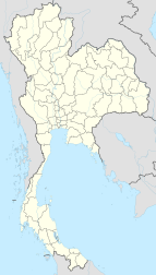
Ko Samui is in the Gulf of Thailand, about 35 km northeast of Surat Thani town (9°N, 100°E). It is the most significant island in the Chumphon Archipelago. The island measures some 25 km at its widest point. To the north are the populated resort islands of Ko Phangan, Ko Tao, and Ko Nang Yuan. Close to Bangrak in NE Samui is the small uninhabited island of Ko Som, and to the northeast of Chaweng is the tiny Ko Matlang. In the southern direction are Ko Taen, Ko Matsum each of which have very small tourist facilities. To the far west are 44 other islands which together compose the Mu Ko Ang Thong National Park which is accessible by a day-trip boat tour from Ko Samui.
...
Wikipedia

