Samal City
| Samal | ||
|---|---|---|
| Component City | ||
| Island Garden City of Samal Pulong Harding Lungsod ng Samal Pulong Harding Dakbayan sa Samal |
||

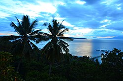
View from Samal Island, looking towards Talikud Island and mainland Mindanao
|
||
|
||
| Nickname(s): IGaCoS "Philippines' Largest Resort" "Island Garden City" |
||
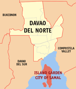
 Map of Davao del Norte with Samal highlighted |
||
| Location within the Philippines | ||
| Coordinates: 07°03′N 125°44′E / 7.050°N 125.733°ECoordinates: 07°03′N 125°44′E / 7.050°N 125.733°E | ||
| Country | Philippines | |
| Region | Davao (Region XI) | |
| Province | Davao del Norte | |
| District | 2nd district of Davao del Norte | |
| Founded | July 8, 1948 | |
| Cityhood | January 30, 1998 | |
| Barangays | 46 | |
| Government | ||
| • Mayor | Aniano Antalan | |
| • Vice Mayor | Al David T. Uy | |
| Area | ||
| • Total | 301.3 km2 (116.3 sq mi) | |
| Population (2015 census) | ||
| • Total | 104,123 | |
| • Density | 350/km2 (900/sq mi) | |
| Time zone | PST (UTC+8) | |
| ZIP code | 8119 | |
| IDD : area code | +63 (0)84 | |
| Income class | 4th city income class | |
| 112317000 | ||
| Electorate | 62,009 voters as of 2016 | |
| Website | samalcity |
|
Samal is a 4th class city in the province of Davao del Norte, Philippines. According to the 2015 census, it has a population of 104,123 people.
Its official name is Island Garden City of Samal (Filipino: Pulong Harding Lungsod ng Samal, Cebuano: Pulong Harding Dakbayan sa Samal) and it is made up of Samal Island and the smaller Talikud Island in the Davao Gulf, making it a part of Mindanao island group.
Samal is a part of the Metropolitan Davao area and is located two kilometers away from Davao City, the largest city and the primary economic center of Mindanao.
The name Samal was derived from the Sama-Bajau peoples, the natives who were the first inhabitants of the island. The first datu in the island was Datu Taganiyug, a native of what is now Peñaplata, today the governance center of the city. In the past, the people of the island name a place about what was the said place known for. For example, the name Peñaplata was derived from the word "piña" or pineapple because of the abundance of pineapple in the area. This, however, is folk etymology as peñaplata literally means "rock of silver" in Spanish. Tagpopongan is the first barangay in the island which name was from the word "tagpo" or meet. It was so called due to the fact that in the fact this place is chosen by the datus as their meeting place. The word Samal was also known before because it was commonly used as surname by datus.
The first business transaction in the island was during the Chinese imperial era. Spanish influence was also felt in the island in the late 1840s when Nueva Vergara (Davao City today) was established.
The Pacific War, which happened during World War II, struck the island. Japanese fighter planes bombed the island. Japanese occupied the island and forced the people to work for four years until they were expelled by the Allied forces. After the war, infrastructure was built, like schools, churches and stores in the area.
...
Wikipedia


