Sachseln
| Sachseln | ||
|---|---|---|
 |
||
|
||
| Coordinates: 46°52′N 8°14′E / 46.867°N 8.233°ECoordinates: 46°52′N 8°14′E / 46.867°N 8.233°E | ||
| Country | Switzerland | |
| Canton | Obwalden | |
| District | n.a. | |
| Area | ||
| • Total | 53.91 km2 (20.81 sq mi) | |
| Elevation | 483 m (1,585 ft) | |
| Population (Dec 2015) | ||
| • Total | 5,066 | |
| • Density | 94/km2 (240/sq mi) | |
| Postal code | 6072 | |
| SFOS number | 1406 | |
| Surrounded by | Giswil, Kerns, Lungern, Sarnen | |
| Website |
www SFSO statistics |
|
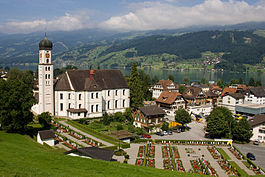
Sachseln is a village and municipality in the canton of Obwalden in Switzerland. Besides the village of Sachseln, the municipality includes the hamlets of Edisried, Ewil and Flüeli-Ranft.
Sachseln is first mentioned in 1173 as Saxhslen.
Sachseln has an area, as of 2006[update], of 53.8 square kilometers (20.8 sq mi). Of this area, 45.4% is used for agricultural purposes, while 39.4% is forested. Of the rest of the land, 3.1% is settled (buildings or roads) and the remainder (12.1%) is non-productive (rivers, glaciers or mountains).
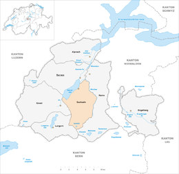
The municipality is located on Lake Sarnen (Sarnersee). It consists of the village of Sachseln and the hamlets of Edisried, Ewil and Flüeli-Ranft.
The geographic center of Switzerland is in Sachseln.
Sachseln has a population (as of 31 December 2015) of 5,066. As of 2007[update], 13.4% of the population was made up of foreign nationals. Over the last 10 years the population has grown at a rate of 8.7%. Most of the population (as of 2000[update]) speaks German (92.8%), with Serbo-Croatian being second most common ( 1.5%) and Portuguese being third ( 1.1%). As of 2000[update] the gender distribution of the population was 49.6% male and 50.4% female. As of 2000[update] there are 1,417 households, while in 2009[update] the total was 2,104 with 1,867 households in Sachseln and 237 in Flüeli-Ranft.
...
Wikipedia


