Rye, New Hampshire
| Rye, New Hampshire | ||
|---|---|---|
| Town | ||

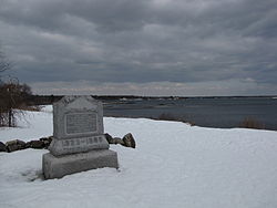
1899 monument marking supposed landing place of 1623
|
||
|
||
 Location in Rockingham County and the state of New Hampshire. |
||
| Coordinates: 43°00′48″N 70°46′15″W / 43.01333°N 70.77083°WCoordinates: 43°00′48″N 70°46′15″W / 43.01333°N 70.77083°W | ||
| Country | United States | |
| State | New Hampshire | |
| County | Rockingham | |
| Incorporated | 1727 | |
| Government | ||
| • Board of Selectmen | Joseph G. Mills, Jr., Chair Craig N. Musselman Priscilla V. Jenness |
|
| Area | ||
| • Total | 36.7 sq mi (95.1 km2) | |
| • Land | 12.6 sq mi (32.7 km2) | |
| • Water | 24.1 sq mi (62.4 km2) 65.65% | |
| Elevation | 75 ft (23 m) | |
| Population (2010) | ||
| • Total | 5,298 | |
| • Density | 140/sq mi (56/km2) | |
| Time zone | Eastern (UTC-5) | |
| • Summer (DST) | Eastern (UTC-4) | |
| ZIP code | 03870 | |
| Area code(s) | 603 | |
| FIPS code | 33-66180 | |
| GNIS feature ID | 0873712 | |
| Website | www |
|
Rye is a town in Rockingham County, New Hampshire, United States. The population was 5,298 at the 2010 census.
The first settlement in New Hampshire, originally named Pannaway Plantation, was established in 1623 at Odiorne's Point by a group of fishermen led by David Thompson. An early settler in Rye was William Berry. Prior to its incorporation in 1726 as a parish of New Castle, Rye was called Sandy Beach and included land in New Castle, Portsmouth, Greenland and Hampton.
According to the United States Census Bureau, the town has a total area of 36.7 square miles (95.1 km2), of which 12.6 square miles (32.6 km2) is land and 24.1 square miles (62.4 km2) is water, comprising 65.65% of the town. The town is located on the shore of the Atlantic Ocean and includes four of the nine islands known as the Isles of Shoals, which lie approximately 10 miles (16 km) out from the mainland. The highest point in Rye is the summit of Breakfast Hill, at 151 feet (46 m) above sea level, on the town's border with Greenland.
As of the census of 2000, there were 5,182 people, 2,176 households, and 1,462 families residing in the town. The population density was 410.7 people per square mile (158.5/km²). There were 2,645 housing units at an average density of 209.6 per square mile (80.9/km²). The racial makeup of the town was 98.71% White, 0.14% African American, 0.08% Native American, 0.46% Asian, 0.10% from other races, and 0.52% from two or more races. Hispanic or Latino of any race were 0.62% of the population.
...
Wikipedia

