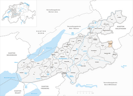
Ruppoldsried
| Ruppoldsried | ||
|---|---|---|
| Former municipality of Switzerland | ||
|
||
| Coordinates: 47°5′N 7°26′E / 47.083°N 7.433°ECoordinates: 47°5′N 7°26′E / 47.083°N 7.433°E | ||
| Country | Switzerland | |
| Canton | Bern | |
| District | Seeland | |
| Area | ||
| • Total | 2.2 km2 (0.8 sq mi) | |
| Elevation | 490 m (1,610 ft) | |
| Population (Dec 2011) | ||
| • Total | 259 | |
| • Density | 120/km2 (300/sq mi) | |
| Postal code | 3251 | |
| SFOS number | 0548 | |
| Surrounded by | Balm bei Messen (SO), Messen (SO), Rapperswil, Wengi | |
| Website |
www SFSO statistics |
|
Ruppoldsried is a former municipality in the Seeland administrative district in the canton of Bern in Switzerland. On 1 January 2013 Ruppoldsried merged into Rapperswil.
Ruppoldsried is first mentioned in 1279 as Ruopolsriet.
During the Late Middle Ages the village was owned by the von Ergeuw family from Burgdorf. The family is mentioned in 1373 during a dispute over land use near the village. At some time before 1506, Konrad von Ergeuw sold the village to Bern. Under Bernese control Ruppoldsried was placed under the control and low court of Mülchi. It was part of the high court of Zollikofen.
The residents were part of the parish of Messen in Solothurn. In the 16th century, when Messen embraced the Protestant Reformation and adopted the Reformed faith, Ruppoldsried followed.
Beginning in the 19th century local farmers began to raise dairy cattle along with traditional agriculture. The village dairy was built in 1884. Today Ruppoldsried and Messen form an intercantonal school district. The village has regular Postauto service from Bern and Lyss. It has retained much of its rural, agrarian character, today nearly two thirds of all jobs in Ruppoldsried are in agriculture.
Ruppoldsried had an area of 2.2 km2 (0.85 sq mi). Of this area, 1.74 km2 (0.67 sq mi) or 79.1% is used for agricultural purposes, while 0.27 km2 (0.10 sq mi) or 12.3% is forested. Of the rest of the land, 0.13 km2 (32 acres) or 5.9% is settled (buildings or roads), 0.04 km2 (9.9 acres) or 1.8% is either rivers or lakes.
...
Wikipedia


