Rudyard, Montana
| Rudyard, Montana | |
|---|---|
| CDP | |
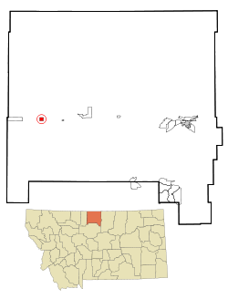
 Location of Rudyard, Montana |
|
| Coordinates: 48°33′38″N 110°33′17″W / 48.56056°N 110.55472°WCoordinates: 48°33′38″N 110°33′17″W / 48.56056°N 110.55472°W | |
| Country | United States |
| State | Montana |
| County | Hill |
| Area | |
| • Total | 0.9 sq mi (2.4 km2) |
| • Land | 0.9 sq mi (2.4 km2) |
| • Water | 0.0 sq mi (0.0 km2) |
| Elevation | 3,114 ft (949 m) |
| Population (2000) | |
| • Total | 275 |
| • Density | 295.8/sq mi (114.2/km2) |
| Time zone | Mountain (MST) (UTC-7) |
| • Summer (DST) | MDT (UTC-6) |
| ZIP code | 59540 |
| Area code(s) | 406 |
| FIPS code | 30-64900 |
| GNIS feature ID | 0776006 |
Rudyard is a census-designated place (CDP) in Hill County, Montana, United States. The population was 275 at the 2000 census.
Rudyard is located at 48°33′38″N 110°33′17″W / 48.56056°N 110.55472°W (48.560633, -110.554737).
Rudyard has the distinction of being the only community in the United States that sits atop a non-oceanic antipode, that being Kerguelen Island.
According to the United States Census Bureau, the CDP has a total area of 0.9 square miles (2.3 km2), all of it land.
Rudyard has antipodes in the Kerguelen Islands making it one of the few places in the continental United States with a non-oceanic antipode.
As of the census of 2000, there were 275 people, 126 households, and 71 families residing in the CDP. The population density was 295.8 people per square mile (114.2/km²). There were 155 housing units at an average density of 166.7 per square mile (64.4/km²). The racial makeup of the CDP was 98.18% White, 0.73% Native American, and 1.09% from two or more races. Hispanic or Latino of any race were 0.36% of the population.
...
Wikipedia
