Rubondo Island National Park
| Rubondo Island National Park | |
|---|---|
|
IUCN category II (national park)
|
|

Rubondo Island National Park
|
|
| Location |
Lake Victoria, |
| Coordinates | 2°18′S 31°50′E / 2.300°S 31.833°ECoordinates: 2°18′S 31°50′E / 2.300°S 31.833°E |
| Area | 456.8 km² |
| Established | 1965 |
| Visitors | 748 (in 2012) |
| Governing body | Tanzania National Parks Authority |
Rubondo Island National Park is one of two Tanzanian National Parks located on an island in Lake Victoria (the other being Saanane Island National Park). The island attracts a small number of visitors each year, mainly game fishermen and bird enthusiasts.
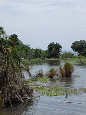
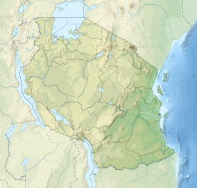
Rubondo Island is located in the south-western corner of Lake Victoria, Tanzania. Rubondo Island is about 150 km (93 mi) west of Mwanza. The main island, Rubondo (2o 18’ S, 31o 50’ E) is 237 km2 in size. The island protects another 11 islets, none much larger than 2 km2. These 10 islands form the Rubondo Island National Park covering an area of 456.8 km2 (176.4 sq mi). Lake Victoria is 1,134 metres above sea level. The highest point on Rubondo is the Masa Hills in the far south, at an elevation of 1,486m (350m above the level of the lake). The main island measures 28 km from north to south and is 3–10 km wide. Rubondo Island is on a rift in the lake. Rubondo essentially consists of a partially submerged rift of four volcanically formed hills, linked by three flatter isthmuses. The island has no rivers and the soil is volcanic. The habitat is mixed evergreen and semideciduous forest, which covers about 80% of the island’s surface area with common species including Croton sylvaticus, Drypetes gerrardii, and Lecaniodiscus fraxinifolius, and often with a dense understory of lianas, or woody vines. The forest is interspersed with patches of open grassland and, all but restricted to the Lukaya area, acacia woodland. The eastern lakeshore is characterised by rocky areas and sandy beaches whilst the western shore supports extensive papyrus swamps, lined with date palms.
There is a bimodal rainfall distribution, with peaks in December and April–May during the October–May rainy season. The annual temperature is 19–26 0C.
Rubondo Island became a game reserve in 1965, to provide a sanctuary for animals. Rubondo Island was gazetted as a national park in 1977. Today Rubondo is uninhabited. Consequently, 80% of the island remains forested today. The 400 “fisher folk” of the Zinza tribe, who lived on the island and maintained banana plantations, were resettled on neighbouring islands and onto the mainland by the government in the late 1960s. As a rule the court passed sentences of six weeks imprisonment for unauthorised landings on the island and six months for attempted poaching (for example, see the story by Idogu on a group of fishermen caught poaching on the island in 1994 at https://www.flickr.com/photos/idogu/819509281/).
...
Wikipedia

