Rubjerg Knude

Rubjerg Knude Lighthouse
|
|
|
Denmark
|
|
| Location | Rubjerg. Hjørring Municipality Denmark |
|---|---|
| Coordinates | 57°26′56″N 9°46′28″E / 57.448939°N 9.774377°E |
| Year first constructed | 1900 |
| Deactivated | 1968 |
| Construction | masonry tower |
| Tower shape | square prism tower with balcony and lantern |
| Markings / pattern | white tower, red lantern |
| Height | 23 metres (75 ft) |
| ARLHS number | DEN-036 |
| Managing agent | Vendsyssel Historiske Museum |
Coordinates: 57°26′58″N 9°46′31″E / 57.44944°N 9.77528°E
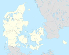
Rubjerg Knude Lighthouse (Danish: Rubjerg Knude Fyr) is located on the coast of the North Sea in Rubjerg, in the Jutland municipality of Hjørring in northern Denmark. It was first lit on December 27, 1900. Construction of the lighthouse began in 1899.
The lighthouse is on the top of Lønstrup Klint (cliff), 60 metres (200 ft) above sea level. Until 1908 it operated on gas which it produced from a gasworks on the site.
Both shifting sands and coastal erosion are a serious problem in the area. The coast is eroded on average 1.5 metres (4.9 ft) a year, which can be seen most clearly at the nearby Mårup Church. Built around 1250, the church was originally 1 kilometre (0.62 mi) from the coast, but was dismantled in 2008 to prevent its falling into the sea.
The lighthouse ceased operating on August 1, 1968. For a number of years, the buildings were used as a museum and coffee shop, but continually shifting sands caused them to be abandoned in 2002. By 2009, the small buildings were severely damaged by the pressure of the sand and were later removed. It is expected that the tower will fall into the sea by 2023.
Rubjerg Knude, Denmark Lighthouse
The lighthouse in 1912
Lighthouse being encroached by the sand dunes
...
Wikipedia

