Rubaga
| Lubaga | |
|---|---|
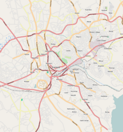
| Map of Kampala showing the location of Lubaga. | |
| Coordinates: 00°18′11″N 32°33′11″E / 0.30306°N 32.55306°E | |
| Country |
|
| Region | Central Uganda |
| District | Kampala Capital City Authority |
| Division | Lubaga Division |
| Elevation | 1,220 m (4,000 ft) |
| Time zone | EAT (UTC+3) |
Lubaga is a hill in Kampala, Uganda's capital and largest city. Its comes from the Luganda word okubaga, a process of "planning" or "making a structure stronger" while constructing it. For example; okubaga ekisenge means to strengthen the internal structure of a wall while building a house. The name also applies to the neighborhood on the hill.
Lubaga is bordered by Mengo to the east, Namirembe to the northeast, Kasubi to the north, Lubya to the northwest, Lungujja and Busega to the west, Nateete to the southwest Mutundwe to the south and Ndeeba to the southeast. The coordinates of Lubaga are:0°18'11.0"N, 32°33'11.0"E (Latitude:0.303056; Longitude:32.553056). The distance, by road, from the central business district of Kampala to Lubaga is approximately 3 kilometres (1.9 mi).
The hill served as location of one of the palaces of the King of Buganda from the 18th century. Kabaka Ndawula Nsobya, the 19th Kabaka of Buganda, who ruled from 1724 until 1734, maintained his capital on Lubaga Hill. The palace on Lubaga Hill was used to plan military expeditions by Buganda's generals. However, during the late 19th century, during the reign of Muteesa I Mukaabya Walugembe Kayiira, who reigned from 1856 until 1884, the palace caught fire and was abandoned. When the Catholic White Fathers came calling in 1879, they were allocated land nearby. Eventually they were given land on Lubaga Hill itself where they built a cathedral, beginning in 1914 which was completed in 1925.
...
Wikipedia

