Roxbury, New Hampshire
| Roxbury, New Hampshire | |
|---|---|
| Town | |
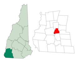
 Location in Cheshire County, New Hampshire |
|
| Coordinates: 42°57′18″N 72°12′21″W / 42.95500°N 72.20583°WCoordinates: 42°57′18″N 72°12′21″W / 42.95500°N 72.20583°W | |
| Country | United States |
| State | New Hampshire |
| County | Cheshire |
| Incorporated | 1812 |
| Government | |
| • Board of Selectmen | James Rousmaniere Tim O'Brien Gerald (Gerry) Davis |
| Area | |
| • Total | 12.2 sq mi (31.6 km2) |
| • Land | 11.9 sq mi (30.8 km2) |
| • Water | 0.3 sq mi (0.8 km2) 2.38% |
| Elevation | 1,375 ft (419 m) |
| Population (2010) | |
| • Total | 229 |
| • Density | 19/sq mi (7.2/km2) |
| Time zone | Eastern (UTC-5) |
| • Summer (DST) | Eastern (UTC-4) |
| ZIP code | 03431 |
| Area code(s) | 603 |
| FIPS code | 33-65700 |
| GNIS feature ID | 0873710 |
| Website | www |
Roxbury is a town in Cheshire County, New Hampshire, United States. The population was 229 at the 2010 census.
The smallest town in Cheshire County, Roxbury was incorporated in 1812 from portions of Nelson, Marlborough, and Keene. By then, settlers had established agriculture among the rolling hillsides in the area, and a community center had developed at what is now called Roxbury Center. It was a "hill farm" community with some scattered small mills. Roxbury's granite quarries, among the most extensive in the Granite State at the time, provided some of the stone for the capitol building of New York in Albany. Much of Roxbury was abandoned in the American Civil War as a very high percentage of its male population was killed in battle. Other residents left after the Civil War to seek a better life in local mill villages or in the American Midwest. Otter Brook Lake, constructed by the Army Corps of Engineers in 1956-58 to control flooding in the Ashuelot and Connecticut River valleys, occupies part of the town's western boundary.
According to the United States Census Bureau, the town has a total area of 12.2 square miles (31.6 km2), of which 11.9 sq mi (30.8 km2) is land and 0.3 sq mi (0.8 km2) is water, comprising 2.38% of the town. The highest point in Roxbury is the summit Bassett Hill, at 1,644 feet (501 m) above sea level.
...
Wikipedia
