Roxbury, Connecticut
| Roxbury, Connecticut | ||
|---|---|---|
| Town | ||
|
||
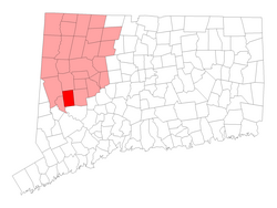
 Location in Litchfield County, Connecticut |
||
| Coordinates: 41°33′07″N 73°18′09″W / 41.55194°N 73.30250°WCoordinates: 41°33′07″N 73°18′09″W / 41.55194°N 73.30250°W | ||
| Country | United States | |
| State | Connecticut | |
| NECTA | Danbury | |
| Region | Northwestern Connecticut | |
| Incorporated | 1796 | |
| Government | ||
| • Type | Selectman-town meeting | |
| • First selectman | Barbara M. Henry (R) | |
| • Selectman | Russell Dirienzo (R) | |
| • Selectman | Jim Conway (D) | |
| Area | ||
| • Total | 26.3 sq mi (68.1 km2) | |
| • Land | 26.2 sq mi (67.9 km2) | |
| • Water | 0.1 sq mi (0.2 km2) | |
| Elevation | 541 ft (165 m) | |
| Population (2005) | ||
| • Total | 2,327 | |
| • Density | 89/sq mi (34/km2) | |
| Time zone | Eastern (UTC-5) | |
| • Summer (DST) | Eastern (UTC-4) | |
| ZIP code | 06783 | |
| Area code(s) | 860 | |
| FIPS code | 09-65930 | |
| GNIS feature ID | 0213498 | |
| Website | www |
|
Roxbury is a town in Litchfield County, Connecticut, United States. The population was 2,136 at the 2000 census.
Roxbury, whose Indian name was "Shepaug", a Mahican name signifiying "rocky water", was settled about the year 1713. Originally a part of Woodbury, the town was incorporated in October 1796.
Mine Hill and its minerals have been associated with Roxbury since the middle of the 18th century. A silver mine was opened here and was later found to contain spathic iron, specially adapted to steel making and a small smelting furnace was built. The abundance of granite found in many of Mine Hill's quarries provided the building material for the ore roaster and blast furnace, as well as for such world wonders as the Brooklyn Bridge and Grand Central Terminal in New York City.
According to the United States Census Bureau, the town has a total area of 26.3 square miles (68 km2), of which, 26.2 square miles (68 km2) of it is land and 0.1 square miles (0.26 km2) of it (0.23%) is water.
Three places in Roxbury, Connecticut are included on the National Register of Historic Places listing. They are:
As of the census of 2000, there were 2,136 people, 848 households, and 620 families residing in the town. The population density was 81.4 people per square mile (31.4/km²). There were 1,018 housing units at an average density of 38.8 per square mile (15.0/km²). The racial makeup of the town was 97.24% White, 0.23% African American, 0.19% Native American, 0.94% Asian, 0.66% from other races, and 0.75% from two or more races. Hispanic or Latino of any race were 1.31% of the population.
...
Wikipedia

