Route 31 (Massachusetts)
| Route 31 | ||||
|---|---|---|---|---|
 |
||||
| Route information | ||||
| Length: | 58.80 mi (94.63 km) | |||
| Major junctions | ||||
| South end: |
|
|||
|
|
||||
| North end: |
|
|||
| Location | ||||
| Counties: | Worcester, Middlesex | |||
| Highway system | ||||
|
||||
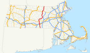
Route 31 is a state highway in the U.S. state of Massachusetts.
Route 31 begins at the Connecticut border in Dudley, where a short (less than 50 yards (46 m) long) unnumbered local road changes to Route 31. Through Dudley and Charlton, it is known as Dresser Hill Road. Dresser Hill road winds over Dresser Hill, with several moderately steep grades and some tight corners.
In Charlton, it intersects U.S. Route 20 a few miles east of the I-90 & I-84 interchange. This provides its only connection with an interstate highway. In Charlton, it is known as Masonic Home Road and Brookfield Road. It then passes Lambs Pond.
Route 31 then enters Spencer, where it parallels the Podunk Pike (Route 49) for several miles. As Charlton Road, it passes the Spencer State Forest. In the center of Spencer, it crosses Route 9. It then turns north towards Paxton; this stretch is scenic and hilly. Several warning signs are seen here for sharp corners warning of a maximum safe speed of 30 miles per hour (48 km/h).
After a couple long, sweeping corners through a forest of pine trees, Route 31 enters Paxton. Paxton Center School comes after a treed-in section. The intersections of Route 31, Route 122, and Route 56 comprise Paxton Center. Route 31 is variously known as West Street and Holden Street in Paxton; it runs east–west in this section. It passes over a hill past Richards Memorial Library, then uses Grove Street for approximately 1/4 mile.
...
Wikipedia

