Rotumah
|
Rotuma Island Rotuma
|
|
|---|---|

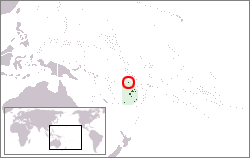
Location of Rotuma in Melanesia.
|
|

Schematic map of Rotuma indicating districts and main villages.
|
|
| Administrative center |
Ahau 12°29.9′S 177°2.82′E / 12.4983°S 177.04700°E |
| Official languages | |
| Ethnic groups | |
| Demonym | Rotuman |
| Government | Dependency of Fiji |
|
• Gagaj Pure
(District officer) |
Niumaia Masere |
|
• Gagaj Jeaman
(Council chairman) |
Tarterani Rigamoto |
| Independence from the United Kingdom as part of Fiji | |
|
• Date
|
October 10, 1970 |
| Area | |
|
• Total
|
46 km2 (18 sq mi) |
| Population | |
|
• 2007 census
|
2,002 |
| Currency | Fiji dollar (FJD) |
| Time zone | (UTC+12) |
| Calling code | +679 |
Rotuma is a Fijian dependency, consisting of Rotuma Island and nearby islets. The island group is home to a large and unique indigenous ethnic group which constitutes a recognisable minority within the population of Fiji, known as "Rotumans". Its population at the 2007 census was 2,002, although many more Rotumans live on mainland Fijian islands, totaling 10,000.
These volcanic islands are located 646 kilometres (401 mi) (Suva to Ahau) north of Fiji. Rotuma Island itself is 13 kilometres (8.1 mi) long and 4 kilometres (2.5 mi) wide, with a land area of approximately 43 square kilometres (11,000 acres), making it the 12th largest island of Fiji. The island is bisected into a larger eastern part, and a western peninsula, by a low narrow isthmus only 230 metres (750 ft) wide, the location of Motusa village (Itu'ti'u district). North of the isthmus is Maka Bay, and in the south Hapmafau Bay. There are a large population of coral reefs in these bays, through which there are boat passages.
Rotuma is a shield volcano made of alkali-olivine basalt and hawaiite, with many small cones, and reaches 256 metres (840 ft) above sea level at Mount Suelhof near the center of the island. Satarua Peak, 166 metres (540 ft) high, lies near the eastern end of the island. While very secluded from much of Fiji proper, the large reef and untouched beaches are renowned as some of the most beautiful in all of Fiji.
There are some islands located at a distance between 50 metres (160 ft) and 2 kilometres (1.2 mi) from the main island, but still within the fringing reef:
Additionally, there is a separate chain of islands between 3 kilometres (1.9 mi) and 6 kilometres (3.7 mi) northwest and west of the westernmost point of Rotuma Island. From northeast to southwest, are:
The geological features of this unique island contribute to its national significance as outlined in Fiji's Biodiversity Strategy and Action Plan.
A 4,200 hectares (10,000 acres) area covering the main island and its small satellite islets is the Rotuma Important Bird Area. The Important Bird Area area covers the entire range of the vulnerable Rotuma myzomela, and the Rotuman subspecies of Polynesian Starling and Lesser Shrikebill. Rotuma also supports isolated outlying populations of Crimson-crowned fruit dove and Polynesian Triller. The offshore islets of Ha’atana, Hofliua and Hatawa have nationally significant seabird colonies.
...
Wikipedia
