Rotstöckli
| Rotstöckli | |
|---|---|

The Rotstöckli from the Titlis Glacier (south-east side)
|
|
| Highest point | |
| Elevation | 2,901 m (9,518 ft) |
| Prominence | 46 m (151 ft) |
| Isolation | 0.3 km (0.19 mi) |
| Parent peak | Titlis |
| Listing | Canton high point |
| Coordinates | 46°46′39″N 8°25′33″E / 46.77750°N 8.42583°ECoordinates: 46°46′39″N 8°25′33″E / 46.77750°N 8.42583°E |
| Geography | |
| Location | Obwalden/Nidwalden, Switzerland |
| Parent range | Urner Alps |
| Geology | |
| Mountain type | Limestone |
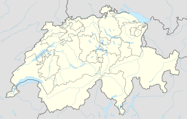
The Rotstöckli (2,901 m) is a peak of the Urner Alps below the Titlis, on the border between the Swiss cantons of Obwalden and Nidwalden. It is Nidwalden's highest point. The summit is split between the municipalities of Engelberg (Obwalden) and Wolfenschiessen (Nidwalden).
...
Wikipedia

