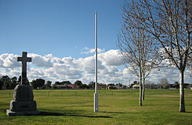
Rosewater, South Australia
|
Rosewater Adelaide, South Australia |
|||||||||||||
|---|---|---|---|---|---|---|---|---|---|---|---|---|---|

Eric Sutton Oval
|
|||||||||||||
| Coordinates | 34°50′46″S 138°30′11″E / 34.846°S 138.503°ECoordinates: 34°50′46″S 138°30′11″E / 34.846°S 138.503°E | ||||||||||||
| Population | 3,338 (2011 census) | ||||||||||||
| • Density | 2,380/km2 (6,180/sq mi) | ||||||||||||
| Established | 1855 | ||||||||||||
| Postcode(s) | 5013 | ||||||||||||
| Area | 1.4 km2 (0.5 sq mi) | ||||||||||||
| Location | 12 km (7 mi) from Adelaide | ||||||||||||
| LGA(s) | |||||||||||||
| State electorate(s) | Cheltenham, Port Adelaide | ||||||||||||
| Federal Division(s) | Port Adelaide | ||||||||||||
|
|||||||||||||
Rosewater is one of the western suburbs of Adelaide and is located 10 km north-west of Adelaide's central business district (CBD). Although mainly residential, there are many shops along Grand Junction Road and the retired "Rosewater Loop" railway line runs through the suburb. Rosewater is split in half by Grand Junction Road and bordered on the east by Addison and on the south by Torrens Road.
Originally, the area was mainly used as vegetable and dairy farmland but became more and more residential as the railway lines and Grand Junction Road were completed and as Port Adelaide grew and developed. Rosewater was also the site of the AdelaideRadio (VIA) maritime radio station system from 1912 to 1963.
Prior to European settlement, the area was inhabited by the Kaurna people. They called the general area north of the Torrens River Yatala retained in an early land division in the area and the cadastral Hundred of Yatala which is the lands administration unit defining real estate boundaries in the southern half of Rosewater and more than a hundred other suburbs north of the Torrens. Further north, the area was known as Yertabulti and Yerta Boldingga, which means 'land of sleep or death' according to John Phillip Gell.
The original subdivision of Rosewater was created in 1855 by Philip Levi, when he subdivided section 1189. The area just south of this, between Grand Junction and Torrens Roads, had been laid out by Osmond Gilles in 1847 and was known as "Yatala" (sections 422 and 2072). The area west of Levi's subdivision was farmland owned by William Henry Gray and was called Graytown (section 699). After Gray's death, Graytown was subdivided and sold as residential lands in 1898. Many of the streets there are named after Gray and his family; Rosetta, Edith, Alice and Jane (now Jennifer Street) were all family members.
The generally accepted explanation of the name "Rosewater" is attributed to Philip Levi who, it is claimed, said "The locality was a swamp, and the perfumes arising from the stagnant water were so offensive that I thought the name of Rosewater would, to some extent, act as a corrective". An alternative etymology came to light in 1945 when a Commissioner of Police report accompanying a parcel of human bone fragments discovered in Rosewater stated the following:
...
Wikipedia

