Roggwil, Thurgau
| Roggwil | ||
|---|---|---|
 |
||
|
||
| Coordinates: 47°30′N 9°24′E / 47.500°N 9.400°ECoordinates: 47°30′N 9°24′E / 47.500°N 9.400°E | ||
| Country | Switzerland | |
| Canton | Thurgau | |
| District | Arbon | |
| Area | ||
| • Total | 12.04 km2 (4.65 sq mi) | |
| Elevation | 440 m (1,440 ft) | |
| Population (Dec 2015) | ||
| • Total | 2,952 | |
| • Density | 250/km2 (640/sq mi) | |
| Postal code | 9325 | |
| SFOS number | 4431 | |
| Surrounded by | Arbon, Berg (SG), Egnach, Häggenschwil (SG), Wittenbach (SG) | |
| Website |
www SFSO statistics |
|
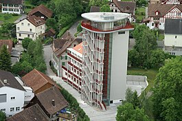
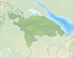
Roggwil is a municipality in the district of Arbon in the canton of Thurgau in Switzerland.
Roggwil is first mentioned in 854 as Megenberti de Rocconwilare when it became part of the holdings of the Bishop of Constance. In the mid-13th Century, these rights were ceded to the Freiherr von Hagenwil. In 1264, the low justice rights over Hagenwil and Roggwil went to the Abbey of St. Gall. In 1364 the court rights acquired by the Breitenlandenberg family, who held the rights until 1432. Then, between 1513-1684 the Bernhausen family acquired these rights, and from 1685 to 1798 they were held by the village itself. Around 1420, Mötteli von Rappenstein bought the tower, which he expanded to a castle. of the tower, she extensions to the castle (from 1517 to 1798 outside space). In 1578, the castle was inherited by Studer von Winkelbach, in 1650 it passed on to the Bernhausens, and from 1740 to 1805 it was in possession of the monastery.
In 900, Roggwil became part of the parish of Arbon, and the Catholics have remained part of that parish into the 21st Century. In 1870, 78% of the population belonged to the Swiss Reformed Church, in 1910 it was 71% and in 2000 the number had dropped to only 51%. Until the construction of the Church of St. Otmar in 1963, the local Catholics visited church services in Arbon and Berg in St. Gallen.
In the second third of the 19th Century there were the two primary school districts, Roggwil and Freidorf-Watt in the village.
Roggwil has an area, as of 2009[update], of 12.04 square kilometers (4.65 sq mi). Of this area, 8.83 km2 (3.41 sq mi) or 73.3% is used for agricultural purposes, while 1.5 km2 (0.58 sq mi) or 12.5% is forested. Of the rest of the land, 1.56 km2 (0.60 sq mi) or 13.0% is settled (buildings or roads) and 0.02 km2 (4.9 acres) or 0.2% is unproductive land.
...
Wikipedia


