Rocky Ford, Colorado
| Rocky Ford, Colorado | |
|---|---|
| City | |

Rocky Ford City Hall
|
|
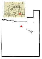
 Location in Otero County and the state of Colorado |
|
| Coordinates: 38°3′4″N 103°43′17″W / 38.05111°N 103.72139°WCoordinates: 38°3′4″N 103°43′17″W / 38.05111°N 103.72139°W | |
| Country |
|
| State |
|
| County | Otero County |
| Incorporated | August 19, 1887 |
| Government | |
| • Type | Statutory City |
| Area | |
| • Total | 1.7 sq mi (4.4 km2) |
| • Land | 1.7 sq mi (4.4 km2) |
| • Water | 0 sq mi (0 km2) |
| Elevation | 4,180 ft (1,274 m) |
| Population (2000) | |
| • Total | 4,286 |
| • Density | 2,521.2/sq mi (974.1/km2) |
| Time zone | Mountain (MST) (UTC-7) |
| • Summer (DST) | MDT (UTC-6) |
| ZIP code | 81067 |
| Area code(s) | 719 |
| FIPS code | 08-65190 |
| GNIS feature ID | 0195481 |
| Website | rockyfordcolo.com |
Rocky Ford is a Statutory City located in Otero County, Colorado, United States. The population was 4,286 at the United States Census 2000.
The community was named for a rocky ford near the original town site.
Rocky Ford is located at 38°3′4″N 103°43′17″W / 38.05111°N 103.72139°W (38.051000, -103.721387).
According to the United States Census Bureau, the city has a total area of 1.7 square miles (4.4 km2), of which, 1.7 square miles (4.4 km2) of it is land and 0.58% is water.
As of the census of 2000, there were 4,286 people, 1,655 households, and 1,136 families residing in the city. The population density was 2,521.8 people per square mile (973.4/km²). There were 1,852 housing units at an average density of 1,089.7 per square mile (420.6/km²). The racial makeup of the city was 72.42% White, 0.40% African American, 1.47% Native American, 0.75% Asian, 0.12% Pacific Islander, 21.86% from other races, and 2.99% from two or more races. Hispanic or Latino of any race were 57.14% of the population.
...
Wikipedia
