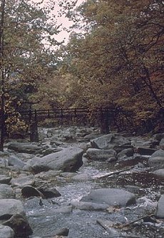
Rock Creek (Potomac River tributary)
| Rock Creek | |
|---|---|

Rock Creek, Washington, D.C.
|
|
| State | Maryland |
| County | Montgomery County, Maryland |
| Cities |
Rockville, Maryland Washington, D.C. |
| Physical characteristics | |
| Main source |
Laytonsville, Maryland 560 feet (170 m) 39°11′56″N 77°08′20″W / 39.1990012°N 77.1388044°W |
| River mouth |
Potomac River 0 feet (0 m) 38°53′58″N 77°03′26″W / 38.899556°N 77.0572°WCoordinates: 38°53′58″N 77°03′26″W / 38.899556°N 77.0572°W |
| Length | 32.6 miles (52.5 km) |
| Discharge |
|
| Basin features | |
| Basin size | 76.5 square miles (198 km2) |
| Landmarks | Rock Creek Park |
| Waterbodies | Lake Needwood |
Rock Creek is a free-flowing tributary of the Potomac River, which empties into the Atlantic Ocean via the Chesapeake Bay. The creek is 32.6 miles (52.5 km) long, with a drainage area of about 76.5 square miles (198 km2). The last quarter-mile (400 m) of the creek is affected by tides.
The creek rises from a spring near Laytonsville in Montgomery County, in the U.S. state of Maryland, and joins the Potomac near Georgetown and the Watergate in Washington, D.C. Beginning in the Derwood–Rockville area in Maryland, the creek flows through Rock Creek Regional Park southward to the D.C. boundary. About 9 miles (14 km) of the creek flow though Rock Creek Park in Washington, where it is fed by several small creeks — Piney Branch, Pinehurst Branch, Broad Branch, Soapstone Branch, and Luzon Branch — and numerous storm sewers.
The Chesapeake and Ohio Canal joins Rock Creek in Georgetown, and used the mouth of Rock Creek as its terminus in Georgetown. At the Tidewater Lock, the creek (and the canal) empty into the Potomac River. This area, called the "Rock Creek Basin" by the Canal Company, which included a mole, causeway, and waste weir, was completed in 1831. Subject to silting up, it was dredged several times for the Canal's use.
...
Wikipedia
