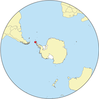
Robert Island (South Shetland Islands)
| Location of Robert Island | |
| Geography | |
|---|---|
| Location | Antarctica |
| Coordinates | 62°24′S 59°30′W / 62.400°S 59.500°W |
| Archipelago | South Shetland Islands |
| Area | 132 km2 (51 sq mi) |
| Length | 11 mi (18 km) |
| Width | 8 mi (13 km) |
| Administration | |
| Demographics | |
| Population | 0 |
| Additional information | |
| Administered under the Antarctic Treaty System | |
Robert Island or Mitchells Island or Polotsk Island or Roberts Island is an island 11 miles (18 km) long and 8 miles (13 km) wide, situated between Nelson Island (South Shetland Islands) and Greenwich Island in the South Shetland Islands. Robert Island is located at 62°24′S 59°30′W / 62.400°S 59.500°W. Surface area 132 km2 (51 sq mi). The name "Robert Island" dates back to around 1821 and is now established in international usage.
...
Wikipedia

