Rivington Pike
| Rivington Pike | |
|---|---|
 |
|
| Highest point | |
| Elevation | 1,191 ft (363 m) |
| Prominence | c. 50 ft |
| Coordinates | 53°37′11″N 2°32′28″W / 53.6196°N 2.5411°WCoordinates: 53°37′11″N 2°32′28″W / 53.6196°N 2.5411°W |
| Geography | |
| Location | Lancashire, England |
| Parent range | West Pennine Moors |
| OS grid | SD643138 |
| Topo map | OS Landranger 109 |
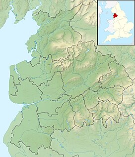
Rivington Pike is a hill summit on Winter Hill, part of the West Pennine Moors, overlooking the village of Rivington in Lancashire, England. The nearest towns are Adlington and Horwich. The Pike is a prominent local landmark which derives its name from the Old English hreof plus ing meaning the rough or rugged hill and pic, a pointed eminence. The hill was recorded as Rovyng in 1325 and Rivenpike in about 1540. Saxton records the name as Rivenpike Hill on his 1577 map.
The pike at 1,191 feet (363 metres) high is the most westerly high point of Winter Hill in the West Pennine Moors. The high moorland is underlain with Carboniferous rocks, the Millstone Grit, sandstones and shales of the Lower Coal Measures which rise high above the Lancashire Plain to the west and Greater Manchester conurbation to the south. The humped shape of the summit coincides with a coal seam of the Lower Coal Measures at around 1,148 feet (350 metres) that outcropped and was mined around 1800. There is evidence of bell pits close to the summit.
The natural vegetation is characterised by areas of blanket bog, impoverished upland heath and acid grassland.
An extensive network of footpaths leads to the summit. The highest part of the route to the summit is a footpath and steps built in the 1990s to combat erosion and prevent further deterioration. From the summit it is possible to see Blackpool Tower, the Lake District mountains, the Welsh mountains and as far as the Isle of Man on the clearest days.
...
Wikipedia

